Minority and Indigenous Trends 2019: Focus on climate change
Africa
- 01
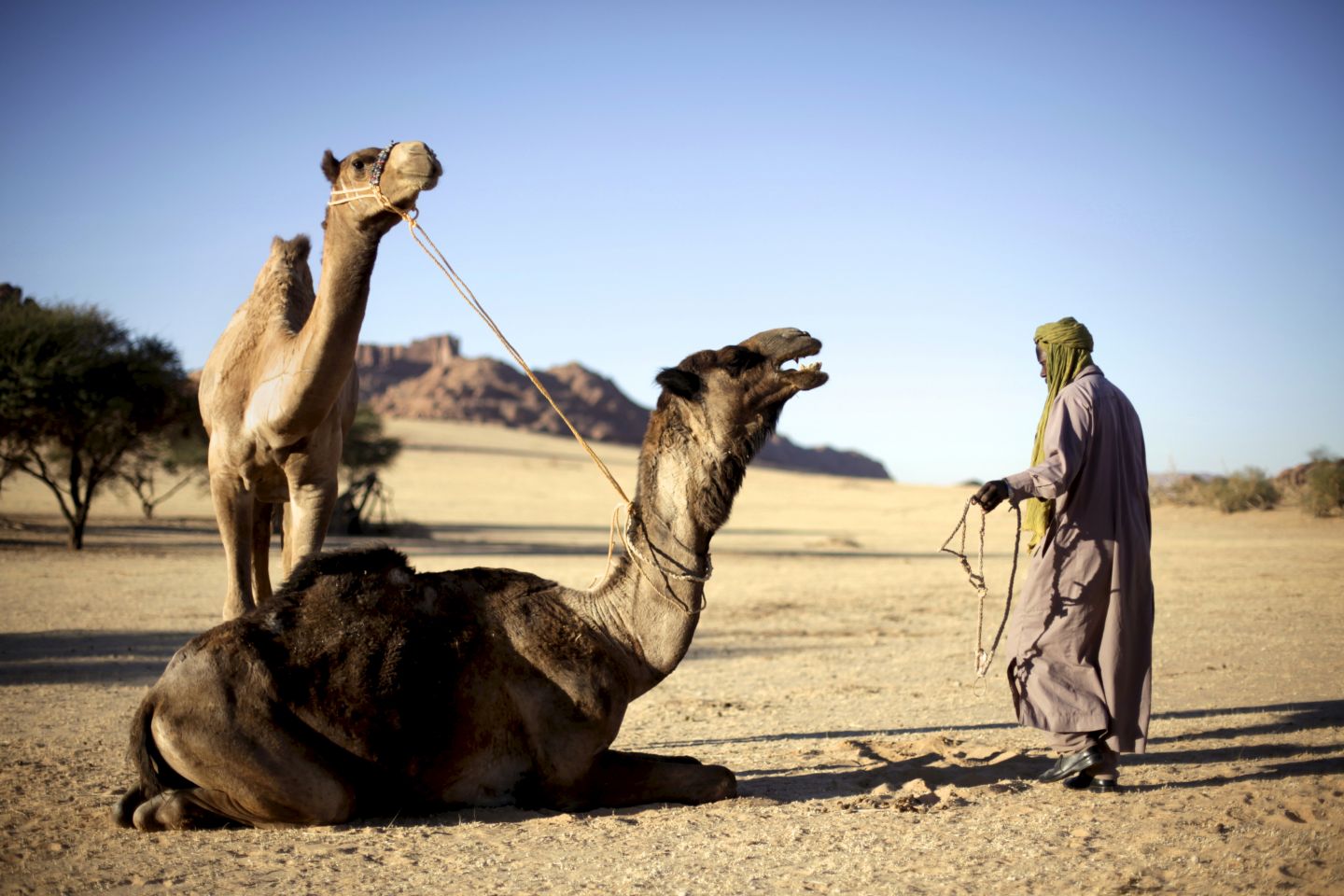
Chad: As deserts spread south, pastoralists face scarcity and drought
By Paige Jennings Frequently ranked as one of the most vulnerable countries in the world to climate change, Chad has for years struggled with a range of environmental pressures that have also threatened its nomadic populations. Seasonal…
0 min read
- 02
Kenya: For Turkana pastoralists, oil offers no easy solutions to poverty and drought
By Nancy Omolo The Turkana people are traditionally pastoralists, a lifestyle adapted to the arid environments of north-western Kenya. Bordering Ethiopia, South Sudan to the north and Uganda to the west, Turkana County is the second largest of…
0 min read
- 03
Kenya: ‘The impact of climate change is worsening the situation of child marriage among the Maasai’
By Nice Nailantei Leng’ete Nice Nailantei Leng’ete, a Maasai human rights activist and advocate for girls’ rights in Africa, has saved thousands of girls from female genital mutilation (FGM) and child marriage through her work with Amref…
0 min read
- 04
Kenya: ‘There has been no life for us since we were moved out of the forest’
By Hamimu Masudi The indigenous Sengwer people, like other hunter-gatherer populations in Kenya, are living in constant threat of eviction from their ancestral lands in Embobut Forest. Classified as protected public forest by the colonial…
0 min read
- 05
Namibia: Sharing local ecological knowledge through digital tools among the Ju|’hoansi
By Megan Laws The Ju|’hoansi of the Nyae Nyae Conservancy in northern Namibia are no strangers to climatic variability. In any given year, most families experience severe drought, wild res and temperatures that drop to -2°C in the winter,…
1 min read
-
By Paige Jennings
Frequently ranked as one of the most vulnerable countries in the world to climate change, Chad has for years struggled with a range of environmental pressures that have also threatened its nomadic populations. Seasonal southerly migration by pastoralists and their cattle in the Sahel – traditionally in the dry season between October and May – has always caused friction with local sedentary populations reliant on the same pasture and wells used by herders to feed and water their livestock.
However, in recent years the impact of climate change has changed patterns in place for many generations, causing new tensions. Over the course of just a decade, landlocked Chad’s dry northern Saharan and central Sahelian zones have spread 150 kilometres south, shrinking fertile farming and grazing areas. Decreasing or more erratic rainfall has forced herders – mostly Mbororo (Fulani, Peulh), Toubou or Gorane – to move south ever earlier in the year, with the result that at times their herds arrive before local farmers have had time to harvest their crops and spoil the yield. They also tend to stay for longer periods or even permanently, further upsetting the delicate balance between Chad’s different ethnicities, lifestyles and livelihoods.
A Toubou herder attends to his camels in the Ennedi Plateau, Chad. Panos / Frédéric Courbet. In the west, the shallow waters of Lake Chad, straddling the country’s borders with Niger, Nigeria and Cameroon, have shrunk by an estimated 90 per cent since the 1960s, disrupting the routes and grazing patterns of livestock farmers from the countries around the lake. Closure of the Chad–Nigeria border since 2014 due to armed conflict hinders traditional trade and transhumance, forcing herders to sell more of their stock in Chad for a lower price.
The situation has been exacerbated by sparse and irregular rainfall across the Sahel region that has caused shortages of both fodder and water for pastoralist herds, forcing them south far sooner with serious consequences for animals and people. These include widespread food insecurity, disease outbreaks and economic dif culties, as well as increased risk of con ict with settled communities. In 2018, with 19 drought- affected departments declaring crisis or emergency phases in the ‘lean season’ from June to September – up from 17 the previous year – the situation left almost 1 million people in the region with little or no access to food.
These issues intersect with intercommunal tensions between herders and farmers in parts of Chad’s eastern, southern and Lake regions, while the presence of refugees from con icts in neighbouring Central African Republic (CAR), Sudan, Libya and Nigeria has placed added pressure on limited resources in host areas. Exposure to armed con ict and banditry has also led to the proliferation of weapons: some northern herders have formed ethnicity-based self- defence militias to protect communities against theft and attack by other armed actors. Another complicating factor has been the emergence of some large ‘neopastoralist’ herds, run by professional drovers and said to be owned by wealthy and powerful Chadians. These groups have at times been accused of disregarding traditional regulations and the rights of local communities as they migrate south.
With almost 20 million head of livestock, pastoral farming accounts for between 15 and 20 per cent of the country’s gross domestic product (GDP) and is said to contribute to the subsistence of around 40 per cent of the population. Historically, however, nomadic herders have had little political voice, though in recent years this has begun to change. Chad has been somewhat ahead of other countries in the region in attempting to mark and organize transhumance roads, set up agreed cattle resting and watering points and liaise with local residents and of cials, with the aim of slowing the migration enough to give farmers along the route time to harvest their crops. Following a national conference in 2005 of cials agreed to draft a new Pastoral Code, re ecting both farmer and herder input and including mechanisms for local conciliation of disputes, to replace the outdated and largely ignored 1959 version. Along with other countries in the region, Chad has also signed the 2013 Nouakchott Declaration on Pastoralism and the 2016 Bamako Declaration, both of which call for reinforcing the resilience of pastoral communities in the face of climate challenges.
On the ground, too, community organizations such as the Association des Femmes Peules Autochtones du Tchad (AFPAT, Association of Indigenous Peulh Women) are working with women, youth and children of local communities to establish alternative, sustainable livelihoods adapted to their changing setting. Emphasizing local approaches grounded in traditional knowledge, their activities demonstrate the value of participatory solutions that include pastoralists themselves – particularly as those are some of the communities worst affected by the changing climate. In the words of AFPAT’s Hindou Oumarou Ibrahim, speaking at the April 2016 signing ceremony of the UN Paris Agreement:
‘Our basic rights and our dignity are under threat. Climate change is adding poverty to poverty every day, and is forcing men to leave home, looking for a better future. Migration is challenging for rich countries, but it’s a tragedy for those who are left behind, for those women and children who have to stay and ght back consequences of climate change on their own.’
-
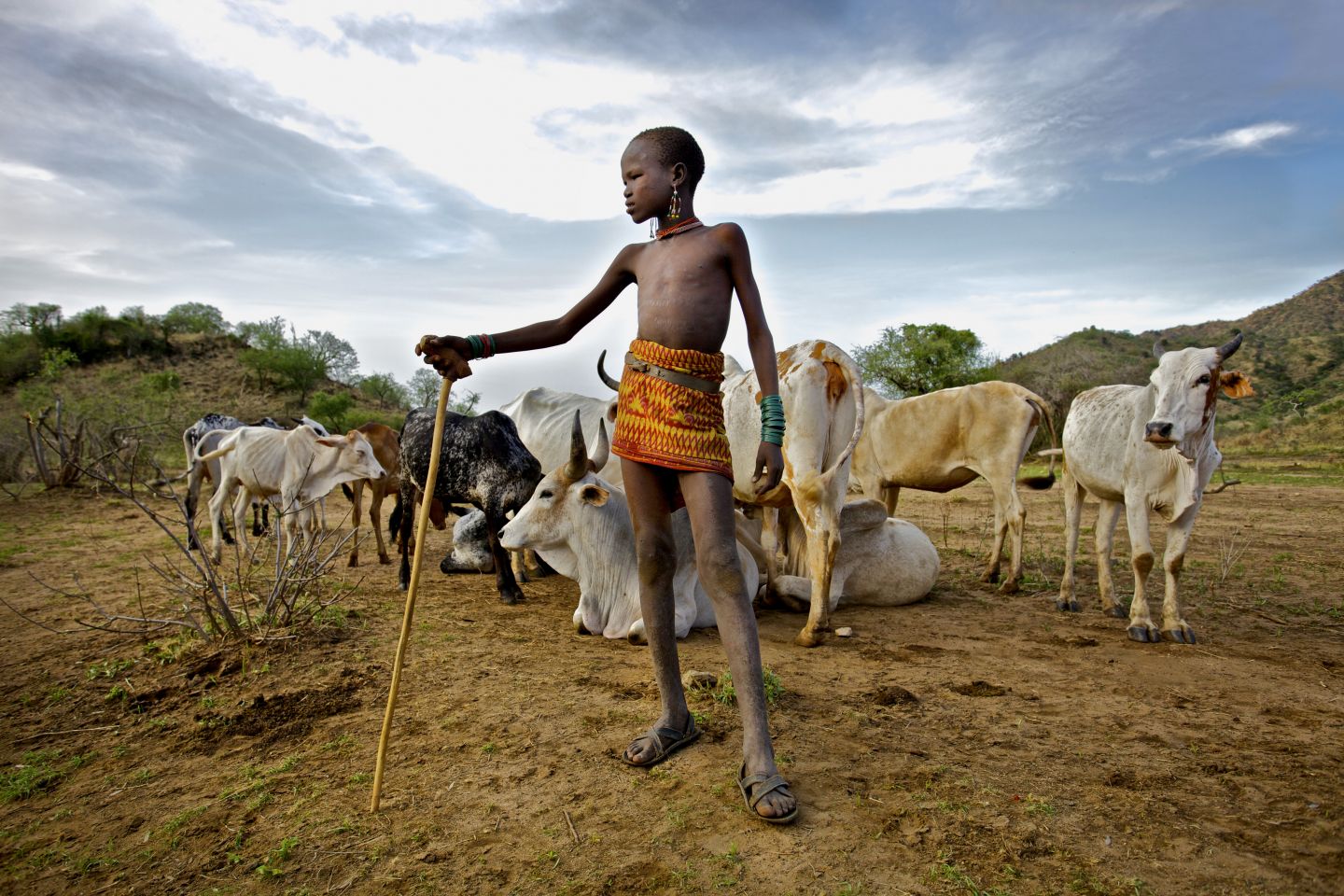
By Nancy Omolo
The Turkana people are traditionally pastoralists, a lifestyle adapted to the arid environments of north-western Kenya. Bordering Ethiopia, South Sudan to the north and Uganda to the west, Turkana County is the second largest of Kenya’s 47 countries and covers some 77,000 square kilometres.
Turkana County is seriously affected by inter-ethnic and cross-border conflicts over natural resources. Turkana, like their neighbours, have a history of livestock raiding – a practice used as a means of extending grazing areas, securing control over new water sources and restocking herds with the livestock of enemy tribes. In addition to the cycle of retributive attacks this has generated, however, an additional challenge has been the transformation of raiding over the years into a more predatory or commercial activity.
A young Turkana herder stands in front of cows left under his supervision. Credit: Panos / Frédéric Courbet. Turkana, like other arid and semi-arid regions of Kenya, has a long history of marginalization from both the colonial and the post-colonial administrations. Due to prolonged isolation and under- investment, the region has some of the lowest levels of human development in Kenya and is the most prone to conflict and insecurity – a situation exacerbated by the recurrent droughts and unpredictable rainfall that have left communities even more vulnerable in their wake. Turkana community members also have limited access to education, elevated levels of health conditions such as child stunting and the highest incidence of poverty in the country. In this context, the ability to adapt to extreme weather and longer- term changes is crucial to maintaining traditional livelihoods in the region.
So far, Kenya has put in place a number of measures to mitigate drought and promote sustainable development. Following the National Climate Change Response Strategy (NCCRS) in 2010, outlining evidence of climate impacts on different economic sectors and proposing various adaptation responses, the National Climate Change Action Plan (NCCAP) of 2013 aimed to implement the 2010 NCCRS and set out a series of actions to enable low-carbon, climate-resilient development. The National Adaptation Plan (NAP) 2015– 2030 builds on this by establishing adaptation priorities, while the Climate Change Act 2016 provides a regulatory framework for mainstreaming climate change considerations into development planning, budgeting and implementation across all sectors of government. Finally, the National Drought Management Authority Act (2016) exercises overall coordination over all matters relating to drought management. Yet these measures have been hampered to an extent by delays and political obstacles.
In the meantime, Turkana County is currently undergoing major changes, including urbanization, population growth and shifting land use, that have put pressures on traditional nomadic lifestyles. Devolution, too, of significant levels of decision-making power to local authorities and increased central budgetary allocations to Turkana since 2013 to reduce the relative marginalization of the area have brought significant change. While a decade ago there were no commercial flights to Turkana, there are now at least every week and in Lodwar, the largest urban centre, hotels and other forms of infrastructure have been built. This process of transformation could be accelerated even further by the recent discovery of vast oil deposits in the region. The reserves are currently being explored by Tullow Oil, a multinational headquartered in London, with reports of more than a billion barrels available and projected investment of US$70 million by the company in 2019.
While some have welcomed the oil industry for the potential development opportunities it could bring the area, such as new road networks and employment for the local community, there has also been considerable resistance and concerns over the likely allocation of profits from any oil extracted, with prolonged demonstrations and roadblocks during 2018 in protest at the employment of outsiders over locals with the company. Given Turkana County’s history of neglect, it is far from certain that oil revenues will be managed transparently and to the benefit of the region.
Indeed, without effective participation and governance, the region’s oil could make existing tensions even worse and lead to further conflict.
In this context, Turkana pastoralists face an uncertain future as increasing pressure on water, land and food security as a result of global warming has undermined their traditional livelihoods and generated conflict with other groups. A key element in maintaining stability and the survival of Turkana culture in the region is ensuring that the impoverished and excluded Turkana population have adequate access to food, services and other essential needs – in the process strengthening their resilience to climate change.
-
By Nice Nailantei Leng’ete
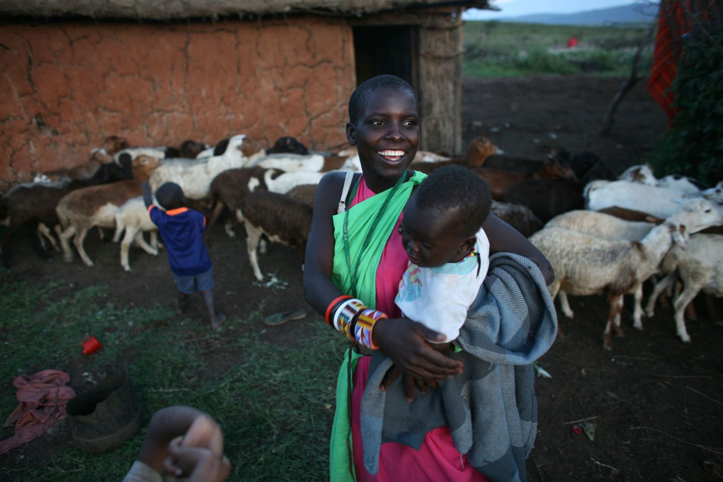
Nice Nailantei Leng’ete, a Maasai human rights activist and advocate for girls’ rights in Africa, has saved thousands of girls from female genital mutilation (FGM) and child marriage through her work with Amref Health Africa, one of the foremost health rights non-governmental organizations (NGOs) in the region. She tells Hamimu Masudi about the effects that climate change is already having on Kenya’s Maasai community and how young girls, in particular, are among the worst affected.
The Amboseli grasslands in Kenya and the Serengeti areas where the Maasai feed their cattle are all drying up – everyone is feeling the heat, the dry spells and the unpredictable rainfalls. When the rains eventually come, they are violent and cause a lot of damage to communities and to cattle. The droughts are widespread and longer, and as a consequence we lack grass to feed the cows – it is very common to see dead cattle all over the place.
Women and girls spend most of the day walking long distances in search of water, because the usual sources of water like rivers dry up often. And as a community that depends on cattle for our livelihood, the lack of pasture causes conflicts with crop growers, who complain of our cattle feeding on their crop fields. The pastoralists sometimes raid each other for grazing lands and cattle rustling. We also get media reports that snow on Mt Kilimanjaro and Mt Kenya is melting away, and we can imagine why foods have become so common. The elders say the nights are now colder and we see frost covering pastures, which is dangerous to the health of our livestock.
A young Maasai girl with her family’s goats. Credit: Alamy / Ton Koene. The impact of climate change is worsening the situation of child marriage among the Maasai. The prolonged droughts are forcing many families into desperate situations of hunger and young girls, as young as 12, are being given away as brides in exchange for cattle. The long walk in search of water also exposes young girls to the danger of sexual abuse and resulting pregnancies. As an activist for the girl child, I know this is happening, but it is dif cult to gauge because of its underground nature.
The other serious issue is that, due to the cultural norms and values, girls who have undergone FGM attract a higher bride price compared to those who are uncut. It is also important to note that the girl who undergoes FGM is in essence being prepared for marriage, so the impact of climate change increases the risks of both child marriage and FGM. Indirectly, then, it can be argued that young Maasai girls are affected most by effects of climate change. A chronic drought and high costs of raising children all too often result in girls being viewed as an economic burden whose best place is a ‘good’ marriage.
The inability to predict the timing of dry and wet seasons greatly undermines our capacity to plan our risk preparedness and disaster management. But the Maasai are very resilient and adaptive to the effects of climate change. We are slowly but steadily venturing into other income-generating activities, like shoe making and business enterprises. In partnership with NGOs and churches, social campaigns and sensitization programmes are also being conducted to fight child marriage and FGM. And through the support of organizations such as Amref, communities are being supported with irrigation and alternative livelihood projects like bee keeping and farming. These additional income sources help communities survive when it foods or when droughts destroy pasture.
As pastoralists, we are always on the move, so some families migrate to faraway places in search of pastures. Some go as far as Tanzania, or the slopes of Mt Kenya and Mt Elgon, but this is risky because it causes con icts with farmers and other pastoralists. Last but not least, our traditional institutions – extended families, clans, the council of elders and the general community – help everyone through tough times.
-
By Hamimu Masudi
The indigenous Sengwer people, like other hunter-gatherer populations in Kenya, are living in constant threat of eviction from their ancestral lands in Embobut Forest. Classified as protected public forest by the colonial government in 1954, the community is now regarded by Kenyan authorities as illegal squatters, despite the fact that Sengwer have resided there for centuries and continue to depend on its resources for its food, livelihoods and cultural traditions.
In 2017, the African Court on Human and Peoples’ Rights ruled in favour of the Ogiek indigenous people, against the government of Kenya in a land eviction dispute similar to that of the Sengwer population. The Court determined that in evicting the Ogiek community from the Mau Forest, the Kenyan government had violated the rights of the Ogiek to their ancestral lands. Much as this ruling should have set a precedent for other conservation projects, the Kenya Forest Service (KFS) continue to forcibly evict Sengwer inhabitants from the area, often violently, with hundreds of homes burnt to the ground since.
From colonialism to conservation – the danger of ‘green’ projects to indigenous Sengwer
The case of the Sengwer has attracted particular attention for being carried out in the name of conservation – and the complicity of international donors such as the World Bank in these abuses. Although the troubles of the Sengwer people began in the colonial era, when their lands were gazetted as forest reserves, in recent years climate funding has been singled out by the community as a major culprit behind the fresh wave of evictions.

Members of the Sengwer community protest their eviction from their ancestral lands in the Embobut Forest, by the government for forest conservation in western Kenya. Credit: Reuters / Katy Migiro. ‘On the surface of it, the KFS guards stand to be blamed but this is only part of the story – there is a whole lot of climate funding that is so blind to human rights safeguards,’ says Milka Chepkorir Kuto, a Sengwer female activist working to protect her community’s land rights. ‘Community complaints and independent expert ndings have clearly shown that the plight of the Sengwer indigenous people is a result of a awed approach to conservation.’
This is underpinned by longstanding accusations that Sengwer are responsible for deforestation in the area – a claim that Chepkorir points out is demonstrably untrue. ‘We have lived many generations in the forest and have protected it,’ she says, adding that deforestation is largely the result of new arrivals in the forest who carry out illegal logging and charcoal burning. ‘The government seems not to see the difference.’
The World Bank’s Inspection Panel, an independent accountability mechanism, was approached by Sengwer community members with complaints about the adverse effects of the World Bank- nanced Natural Resources Management Project (NRMP), which ran from 2007 to 2013 in Mount Elgon, the Cherang’any Hills and other water catchment areas in the country. Reporting in 2014, the Panel criticized the project’s implementation approaches for non-compliance with the WorldBank’s safeguard policies and failure to involve the community in the management of their forest resources, thereby creating conditions that led to evictions.
Another project, the EU-funded Water Towers Protection and Climate Change Mitigation and Adaptation project, has also attracted signi cant criticism for its contribution to the human rights violations against the community. In January 2018,
following a spate of attacks by armed KFS guards on Sengwer activists, homes and livestock, three UN Special Rapporteurs issued a joint statement expressing their concerns about the plight of the Sengwer people as a result of project. Besides calling on the Kenyan government to immediately halt the evictions and conduct investigations into these abuses, it also called on the EU to suspend funding until steps had been taken to ensure indigenous rights were respected. Directly after their statement, a raid by the KFS left a Sengwer man dead and another injured, an action that prompted the EU to immediately suspend funding.
Living with eviction – the impact of resettlement on Sengwer residents
‘Evictions have been affecting children from an early age, making it harder for girls to acquire the education that would help them recognize their legal rights, and develop alternative economic ways to provide for their families. Evictions not only affect Sengwer women, but also affect Sengwer girls, making them susceptible to harsh experiences and exposing them to situations where they are more vulnerable like getting into unions at an early marriage and most often with older men, thereby compromising their childhoods, and rights like education, play, reproductive health.’
Milka Chepkorir Kuto
The brutal process of the KFS’s forced evictions have been well documented, with thousands of Sengwer homes burnt to the ground, but these actions have also had a more intangible, longer lasting impact on their cultural and spiritual traditions. Milka has documented testimonies from a variety of affected community members in Embobut, Kapyego and Yatoi in Western Kenya that illustrate the wide ranging effects of evictions. From lack of access to medicinal herbs to early marriage, these are undermining the social fabric of the community and posing particular challenges for Sengwer women and girls. ‘Evictions are disrupting the family as a social institution – men are deserting their families,’ she explains. ‘The clans and kinship system is being affected by distance, making it hard for people to adhere to the traditional norms that guide marriages and other traditional practices among the Sengwer community.’
The interviews she has gathered from fellow Sengwer testify to the heavy burden – social, economic, psychological – that displacement has exacted on communities. The loss of livelihood that many face after losing access to the forest forces community members to engage in poorly paid, insecure employment:
‘Many live on other people’s lands and work as a labourer to sustain their families. Life has become dif cult for Sengwer women and their families. Previously, they used to have enough milk from their livestock to sell and consume, but now most children do not drink milk even weekly since their mothers are not settled and are unable to provide as much for them.’
Community member
The ever present possibility of eviction also creates greater uncertainty for community members in the forest, as well as the threat of intimidation and physical assault during the evictions. ‘During evictions, verbal abuse and physical violence, including sexual violence, take place,’ says Chepkorir. ‘The women who experience these violations are not aware of the legal rights or mechanisms they could take in response to the violence.’
Custodians of the forest
A sad irony of the treatment of Sengwer as a threat to nature is that, in reality,
the exact opposite is true – given their dependence on the continued health of the local ecosystem and its resources, the community have a particular interest in maintaining the forest and have stewarded it sustainably for many generations. This is reinforced by their deep spiritual connection to the land. ‘Sengwer women, just like every member of the community, cherish their culture,’ says Milka. ‘The community has sacred places in the forest where they perform their cultural rites and rituals.’ This reinforces the pain of community members who have suffered displacement as many of these vital sites are now off limits.
Unlike, for example, the illegal loggers operating in the area, Sengwer are also careful to exploit natural resources in a sustainable fashion to ensure their continued productivity for many years to come. This is the case with their use
of herbs for traditional medicines, a practice carried out for centuries by Sengwer women with care and respect. ‘Generations have been taking herbs from the forest and glades for good health,’ says one Sengwer woman. ‘Women who go extracting and collecting herbs do not cut down a tree for herbs, but rather extract the specific part and leave the entire tree to continue growing.’ Without access to these herbs, however, health issues among displaced Sengwer have increased.‘In our Sengwer culture, when was a woman even allowed to cut down a green tree? Why don’t they just allow women and their children to go back and live in the glades? Our children are suffering from diseases they never suffered from when we lived in the forest; there are a lot of problems and bad health conditions. We would just like to be allowed to access our herbs, good and fresh air and clean water in the forest for our children and grandchildren. A woman is traditionally harmless to the trees. If they [KFS] claim they want to protect the trees, let the government therefore leave women out of evictions.’
Community member
A new approach
The heavy human cost of many large, top-down projects such as the donor- funded programmes in Embobut Forest point to the need for a new approach to climate and conservation projects on indigenous lands – one that not only respects, not disregards, the rights of the communities themselves but also engages them as equal partners in these efforts. The Kenyan government and international donors could, by upholding the rights of indigenous populations to their lands, also achieve signi cant environmental bene ts by supporting tried and tested approaches to the management and preservation of natural resources. This would help promote sustainability effectively without sacri cing the needs of marginalized communities in the name of conservation.
‘Do you think we should hope for the return of our ancestral land? Should we just agree with the government that we have left the forest as we negotiate for only grazing permission? Because these evictions and the loss they have caused us are becoming too much. But we still wonder where they want us to go together with our families, leaving our ancestors behind.’
Community member
-
By Megan Laws
The Ju|’hoansi of the Nyae Nyae Conservancy in northern Namibia are no strangers to climatic variability. In any given year, most families experience severe drought, wild res and temperatures that drop to -2°C in the winter, then sudden ooding, dramatic thunderstorms and temperatures that soar to 38°C in the summer.
In the past, it was this seasonal cycle and not the months of the Gregorian calendar that marked a kuri ‘year’. Today, these cycles appear to be getting longer. The heavy rains of summer are arriving later each year and the cold nights of winter feel more frequent than before. For the region’s indigenous inhabitants, the stretching of seasons and the intensity of the drought, the variability of the rainfall and the extreme shifts in temperature are warning signs of climate change. These are also features of a semi-arid desert landscape that has long fluctuated between extended periods of drought and periods of relatively high rainfall.
Within the Namibian context, being able to discern between real, long- term threats to the region and what are long-standing patterns that the fauna and ora are well-adapted to endure and recover from are crucial to local livelihoods. As a ‘conservancy’, the region falls under the aegis of Ju|’hoan speakers. In Namibian legalese, they are the region’s ‘traditional community’ – they recognize a common ‘chief’ or ‘traditional authority’, share the same language, cultural heritage, customs and traditions, and inhabit the same communal area. While they are not its legal owners, they are the region’s primary custodians and they hold ancestral rights to manage and utilize the resources found within it. These rights came into effect shortly after Namibia achieved independence from South Africa in 1990. By granting these rights to people living in Namibia’s vast, rural landscapes, the aim was not only to achieve social-ecological sustainability but also to give people opportunities for economic development and political self-determination after decades of subjugation under the apartheid government of South Africa.
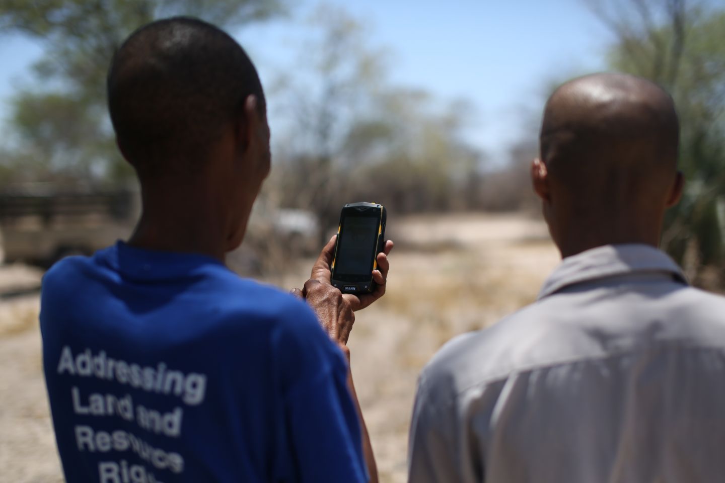
Two rangers for the Nyae Nyae Conservancy test out a prototype for reporting incidents of poaching. Credit: Megan Laws. After years of community meetings and heated discussions, the Nyae Nyae Conservancy opted for a mixed subsistence economy of trophy and own-use hunting, foraging and harvesting, animal husbandry and agriculture, and research and tourism. The off-take is managed through a quota-based system, and the numbers for these are determined by a combination of aerial surveys, annual counts, and monitoring and reporting. These are undertaken by a team of rangers dispersed throughout the region and the environmental wardens and non-governmental organizations, such as the Nyae Nyae Development Foundation of Namibia, who work alongside them. It is an onerous task, and opinions are starkly divided between those who hail it as a conservation success story and those who claim that it is failing – in terms of both achieving social-ecological sustainability and economic development.
There is clear evidence of success. By securing grants, gathering research and lm fees and supporting trophy- hunting and other commercial enterprises, the conservancy garners a large enough income to maintain solar-powered boreholes for 37 communities scattered throughout the 9,000 square kilometres region, distribute annual cash benefits to over 1,500 members and support numerous community projects, from small gardens to animal rearing and craft production. They remain the only indigenous community in southern Africa with both access to a large, ancestral territory and the rights to forage and hunt with traditional weapons. Their traditional n!ore land-use system continues to ensure the careful management of scarce resources, especially in times of drought.
Nevertheless, the situation remains challenging for many community members who still struggle with poverty and insecurity. Hunger is a daily battle for all but a few individuals with stable employment in town. A government feeding programme brings bags of maizemeal to destitute families throughout the year, but these alone are not enough to feed them. This pushes families towards town and into debt. An illegal invasion of cattle herders from the south is also threatening rangelands within the region, and poaching is increasing, both around the municipal town at the centre of the region and on the conservancy’s borders. The distances between communities within the region are immense, making it difficult not only for residents and rangers to share local ecological knowledge and report their concerns, but also for relevant authorities and stakeholders to analyse and address these.
In 2015, to complement their ongoing efforts to achieve social-ecological sustainability and support communities through larger quotas, the Nyae Nyae Conservancy embarked on a new project to develop digital tools for expanding and streamlining monitoring and reporting. Working with Extreme Citizen Science, a research group at University College London, the conservancy designed two mobile applications for recording evidence of poaching and illegal grazing with the aim of using the data in an ongoing court case. These mobile applications were then expanded to support rangers to monitor and report back on animal sightings, and further applications designed for the purposes of mapping protected tree species or tracking regrowth rates in harvested plants. These applications are icon- based and therefore do not require high levels of print or digital literacy, and they allow rangers to record GPS coordinates that pinpoint immediate threats and areas of concern and support longer-term analysis and visualization of trends within the region.
The central aim of this work is to empower the wider community to voice their concerns and engage in the monitoring and reporting work that the conservancy depends upon. There are both technological and social challenges, however, that limit the extent to which these can complement current efforts. Poor telecommunications infrastructure prevents people from sharing knowledge quickly; having only minimal solar-power for electricity makes charging batteries a challenge, and, of course, only a handful of people have smartphones. Furthermore, only those who are formally paid to participate as rangers can, realistically, engage in monitoring and reporting work. Hunting and gathering is both risky and challenging, meaning people are increasingly pushed (as the local saying goes) to zula ka ku |xoah, ‘roam in order to live’ – to go back and forth from territory to town in search of work or patronage.
There are challenges, too, in establishing a clear and equitable interface between indigenous knowledge and new technologies. While the participatory design process employed with communities has meant that local people can both categorize and draw icons that make sense to them, not all local ecological knowledge is translatable in this way. It is also not clear what effect rei cation may have, and what new regimes of transparency these efforts may bring about.
Neighbouring communities face similar issues of environmental mismanagement and land encroachment that also impact upon local efforts to achieve social- ecological sustainability. As rangelands on the other side of the conservancy fence have been overgrazed, cattle herders have cut the fences into Nyae Nyae and allowed their cattle in to graze. Similarly, as deforestation has increased, either for logging or to make way for farming, so has the pressure from poachers who follow wildlife into the conservancy. While poor management and resource competition is driving this process, climate change heightens these impacts and brings new uncertainties. These are challenges that cannot be addressed simply through monitoring and reporting, but monitoring and reporting does, nevertheless, play a vital role. Current efforts to expand upon this work of drawing upon local ecological knowledge and bringing local people into the process, through both digital tools and broader forms of advocacy, are therefore important next steps. They mark a move towards gathering long-term, georeferenced data but also towards finding new ways to confront both a changing socio-political landscape and a changing climate.
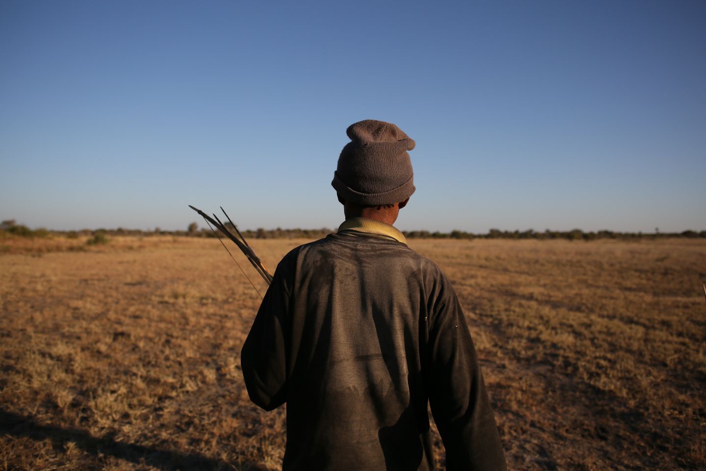
Top photo: A hunter with his bow and arrow set in northern Nyae Nyae, Namibia. Megan Laws.
Americas
With a number of recent studies suggesting that minorities are on average more exposed to air pollution, this signals how closely the issue is tied to a climate justice perspective.
- 01
Canada: ‘Everything is Interconnected – if you remove one element the other topple over’
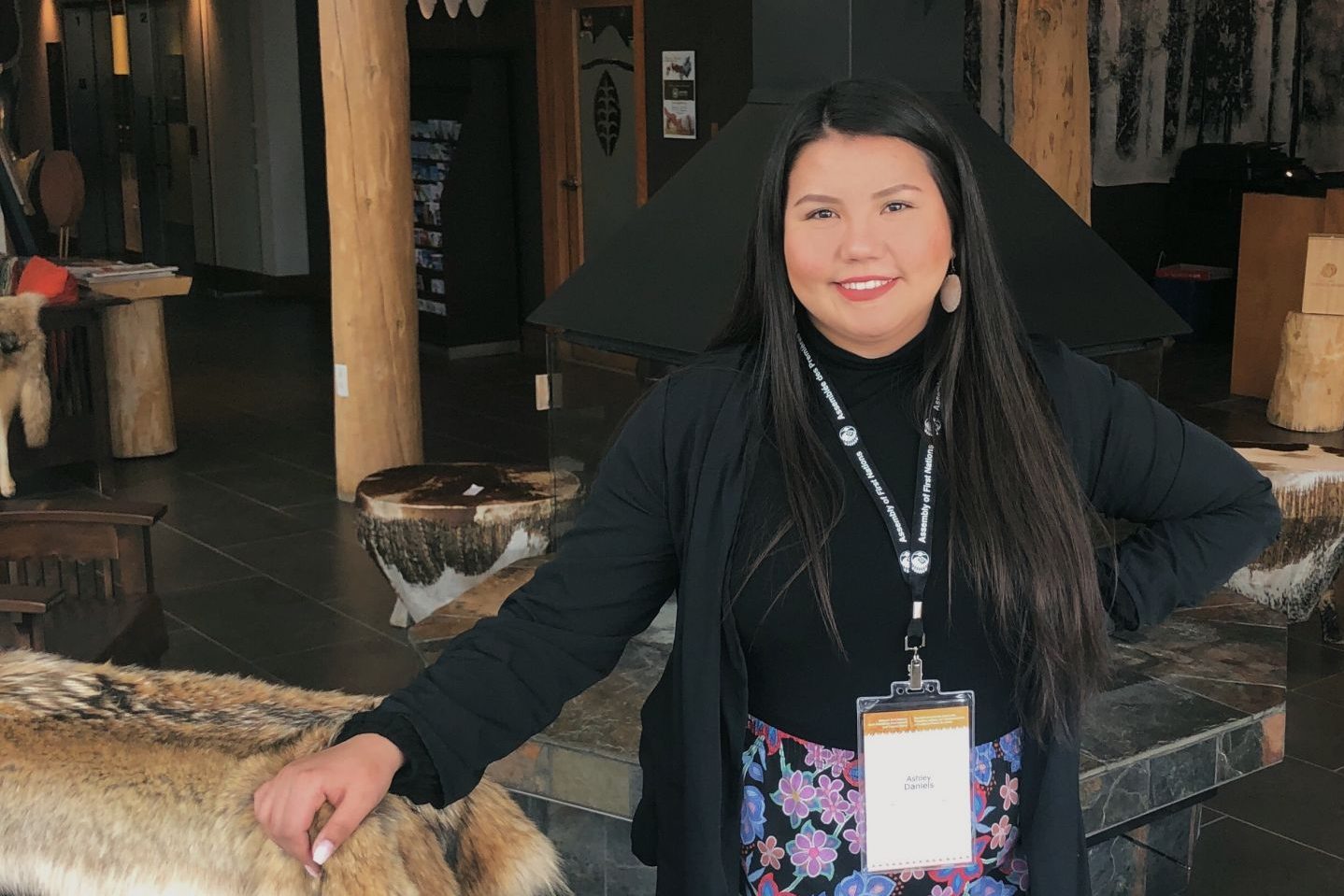
By Ashley Daniel Ashley Daniel, a Dakota Ojibway indigenous youth environmental activist and UN Youth Delegate, tells Alicia Kroemer about how her upbringing by the lake and forests of Swan Lake First Nation has informed her life and work…
0 min read
- 02
Canada: ‘Some people say it’s going to be indigenous people to stop climate change, but it will take every single person, not just indigenous people’
By Kanahus Manuel Kanahus Manuel is an indigenous activist, author, birth keeper and founding member of the environmental indigenous activist group Tiny House Warriors – a protest movement against extractive industries on indigenous…
0 min read
- 03
Ecuador: Indigenous communities lead the fight against climate change and oil extraction on their land
By Karleen Jones West and Todd A. Eisenstadt In the centre of Ecuador’s Amazon forests, the Kichwa people of the Pastaza River watershed village of Sarayaku have worked to document how climate change affects their community and their…
0 min read
- 04

Panama: The devastating cost of ‘green’ development for the indigenous Ngäbe-Buglé community
By Jaume Rius Lopez Guaymi are the most numerous indigenous people in Panama. They are also known by the name Ngäbe and are closely af liated with a small group known as Buglé. They traditionally live in the western provinces of Bocas del…
0 min read
- 05
Peru: Hunger and malnutrition among Shawi communities in the Amazon
By Carol Zavaleta While Peru has enjoyed a protracted economic boom, the situation for many of its indigenous communities remains challenging. Indeed, in some areas of the Peruvian Amazon, food security and nutrition are more strained than ever…
0 min read
- 06
United States: Hurricane Katrina hit minorities in New Orleans hardest – and without effective intervention the next disaster will do so again
By Lisa Overton Almost 14 years on, New Orleans is still recovering from the devastation wrought by Hurricane Katrina in August 2005. Causing unprecedented economic damage and bringing an entire city to a standstill, without access to…
0 min read
-
By Ashley Daniel
Ashley Daniel, a Dakota Ojibway indigenous youth environmental activist and UN Youth Delegate, tells Alicia Kroemer about how her upbringing by the lake and forests of Swan Lake First Nation has informed her life and work since.
I grew up on the reserve surrounded by nature, living in harmony with it in a sustainable lifestyle. I rst got interested in climate change when I was 10 years old and watched my neighbour gathering rain water and composting on the reserve. I was really interested and curious to see what they were doing and why. I’m also interested in how technology in harmony with nature could potentially help our environment and our people. When I think about the environment, I think about who we are as indigenous people. I think about the violence done to the land and people through colonialism, through resource extraction.
Water, air, land, all of it, the sun, moon, ocean, they are all sacred and connected. As we see
it in indigenous culture, everything is interconnected – if you remove one element the others topple over. Life is circular and holistic. We eat the plants that grow from the Earth and breathe the air around us. Industries pollute water, the Earth and the air – all of these elements we need to live. But people around the world are now opening up their eyes and seeing this in the way that we see it. But it is not just opening up our eyes but also taking action – the Earth requires urgent action as how we are going right now, it is a downward spiral.The Earth is our mother: we come from her, we are part of her. This was something I knew growing up surrounded by nature. You cannot just take and take and take from the Earth, you must also give back. We have to replant trees; we have to honour her water. Our mother is dying because of climate change. It is not just humanity that is affected, it is our animal, insect and bird relatives who are also dying. They don’t have a voice to communicate to us that they are being hurt, that their homes are being destroyed because of us. It is a very sel sh thing to not think about all the living creatures who also live on this planet who are negatively impacted by environmental destruction. They deserve to be here just as much as we do.
A portrait of Ashley Daniel, a Dakota Ojibway indigenous youth environmental activist. Supplied by Alicia Kroemer. Because the youth are not afraid to say how it is, they are not bound to anything – we just care about the future of the planet which we are growing up in. We are more impacted than our parents and grandparents by climate change. We see a problem and we want to change it. If we can come together collectively, regardless of where you are from and take action, we can be effective. The word is out, the ones that are advocating are becoming stronger and stronger.
There are a lot of aims to discuss in dismantling old power systems in Canada for indigenous issues. We need recommendations to the plastics and beef industries. Our Earth cannot do anything with the plastics we pollute it with: it is not giving back, it is only doing harm. That is a major issue I will be advocating for at the UN. My ancestors moved around the land and took only things that they could travel with. They did not leave waste. In indigenous culture you leave the land as you found it. My ancestors would have words that I cannot translate in English to express the sorrow they feel about the present state of the world. Indigenous peoples are first-line defenders against state and extractive industries because we are not afraid to say no. We also have the United Nations Declaration on the Rights of Indigenous Peoples (UNDRIP) as a protective document that we can stand on to hold these states and industries accountable, not only to indigenous peoples, but to all people to protect the environment which provides life for us all. We need more people in the government system saying no with us too.
-
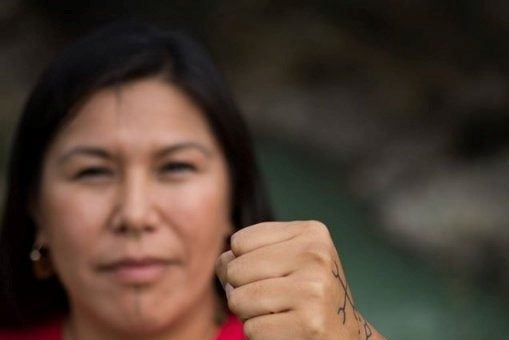
By Kanahus Manuel
Kanahus Manuel is an indigenous activist, author, birth keeper and founding member of the environmental indigenous activist group Tiny House Warriors – a protest movement against extractive industries on indigenous territories. She explains to Alicia Kroemer how indigenous communities, particularly women and youth, have been at the forefront of environmental resistance – and the important contribution they are now making to the ght against climate change.
I am Kanahus Manuel. My name means Red Woman in Tanaka. I am from both Secwepemc nation and Tanaka nation – they border each other on the Rocky Mountains on the west coast of British Columbia in Canada. The Secwepemc territory is still to date unceded and unsurrendered. There are 10,000 Secwepemc living there. It is a very rare temperate inland rainforest.
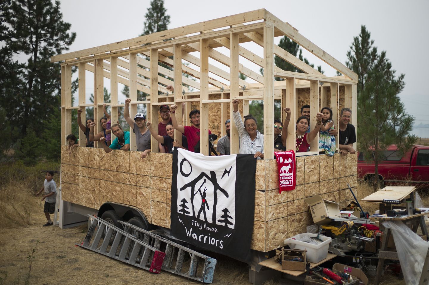
Members of the Tiny House Warriors campaign at work. Photo supplied by Kanahus Manuel. The landscapes, geography and biodiversity make up so much of who we are. Everything we are is from the land. With indigenous communities, it always comes back to the land. We have been able to sustain ourselves for thousands of years. We have place names in our language that are as ancient as the mountains around us. We have a close relationship to and dependence on our land, unbroken since the beginning of time.
Right now, one of the biggest threats to our land and livelihood is industry, as it has always been. Resource extraction, in the form of pipelines, logging and mining, continues to threaten our people. Here in Canada we are currently facing threats of unconsented resource extraction and destructive access into our territories with expansion of roads and pipelines. Today, the Canadian government is trying to build the Kinder Morgan/Trans Mountain Pipeline on Secwepemc territory, and they now own the company, which they bought for C$4.5 billion in 2018 from Kinder Morgan, a Texas-based company.
This Trans Mountain Pipeline threatens thousands of clean glacier creeks, streams and lakes. It is a bitumen pipeline. Bitumen is toxic; it is not conventional oil, you cannot clean it up with conventional oil spill methods – it sinks. This is why we bring attention to it and connect it with some of the big mining disasters we’ve had in the past. We have seen rst-hand that government and corporations do not invest enough into cleaning up environmental disasters from these projects. They never cleaned up the Mount Polley mine disaster that happened in our territory in 2014, they just covered it up. The toxins of that disaster are continuing to spill into one of the deepest glacier-fed lakes in the world, Quesnel Lake.
‘Right now, one of the biggest threats to our land and livelihood is industry, as it has always been. Resource extraction, in the form of pipelines, logging and mining, continues to threaten our people.’- Kanahus Manuel
Kanahus Manuel, founding member of environmental indigenous activist group ‘Tiny House Warriors.’ Photo supplied by Kanahus Manuel. We look ahead to the next 10,000 years. If our ancestors have been here for 10,000 years and we are still able to drink from the glacier-fed streams today, what do we have to do to ensure 10,000 more years of clean water for future generations? Right now, our glaciers are receding at a rapid rate all around the world. What will it look like when our glaciers are gone? What will that look like for humanity?
In protest against this violence on our land and communities, we have started the Tiny House Warriors movement. The Canadian government has always displaced us from our land, yet we have always been mobile. We have currently set up tiny houses on wheels at Blue River, stopping ‘man camps,’ which bring in hundreds of Trans Mountain Pipeline male construction workers. In addition to the environmental destruction of resource extraction, the presence of ‘man camps’ brings with it an increase in sexual attacks and violence towards indigenous women, contributing to the reports of missing and murdered indigenous women. The increase in violence towards women has occurred near similar camps in northern British Colombia, northern Alberta and North Dakota. This is why we chose to put our tiny houses first on the ground here at this site this past year.
We need people on the ground. The power that indigenous people have is often found in their leaving the reserve. I am telling them to leave that little prison and exercise rights on all territories and stop resource extraction. Some people say it’s going to be indigenous peoples who stop climate change, but it will take every single person, not just indigenous people. It is going to take every single one of us on this planet. To the non-indigenous world, I say to you: this is your government; this is your history of colonialization and oppression. You need to take responsibility and fight back for protection of the lands and water.
‘We are not going to let the old boys’ club and rich people around the world continue to control and destroy the planet. We are the masses that are waking up to climate change, and the urgency is now.’ – Kanahus Manuel
Today we see a movement happening in our indigenous nations, that it is the women who are standing up. An indigenous woman started the Standing Rock Protest. Indigenous women have initiated the healing from the violence of colonialism. It is through this healing that the women found their voice to stand up to our oppressors, against state and extractive industries. The women are beginning to nd their voice and the men are beginning to stand by their side as our indigenous communities heal.
Indigenous youth hold vast potential power – they are the ones who have the warrior spirit. They are young and able bodied, they are able to be out there on the frontlines, they have artistic minds that can be creative in finding new ways to resist. Indigenous youth have such a huge job on their hands and it’s going to take that creativity and youthful spirit to be able to make change. Indigenous youth can change the world. Once they find their voice, there is a ripple effect and we will continue to see more indigenous people coming to the forefront and speaking out against climate change and protecting our Earth. These young people are bringing us into a new era – a new generation of resistance.
Every day, we are striving to become the independent, strong, thriving indigenous nation that we envision. But this is going to take work at each individual level. We are not going to let the old boys’ club and rich people around the world continue to control and destroy the planet. We are the masses that are waking up to climate change, and the urgency is now. I encourage everyone to start thinking and planning for solutions. I call on indigenous communities around the world to pull away from dependence on colonial states. We saw people standing up around the world for Standing Rock, standing up against destructive extractive industries. It’s going to continue. Follow the voices of the indigenous women and youth as they lead us. We are empowered by protest, both indigenous and non- indigenous, to fight for our lands and water to ensure our future survival.
-
By Karleen Jones West and Todd A. Eisenstadt
In the centre of Ecuador’s Amazon forests, the Kichwa people of the Pastaza River watershed village of Sarayaku have worked to document how climate change affects their community and their livelihood. In June 2012, two generations of Sarayaku’s indigenous leaders – José Gualinga and Marlon Santi – travelled to Quito to meet with scientists at the Ponti cia Universidad Católica del Ecuador (PUCE).
Seeking greater ties between some of Ecuador’s leading Earth scientists and indigenous communities, Sarayaku’s leaders wanted to measure climate change on the ground to improve Kichwa environmental stewardship and ensure their adaptability.
As a belief system, indigenous cosmovision regards nature as an essential component of humanity. Yet unlike many Western belief systems – including some religions and political ideologies – it is compatible with and complemented by the philosophy of science. In Ecuador, indigenous peoples are harnessing their knowledge of Pachamama – Mother Nature – and finding scientific support for ancestral traditions, all in an effort to protect their lands from a changing climate.
Furthermore, indigenous communities in Ecuador recognize the role that global capitalism plays in creating climate change. Some indigenous leaders argue that the rejection of capitalist production and consumption are necessary not only to protect indigenous traditions, but also to sustain the Earth for future generations. As Sapara leader Ricardo Ushigua explained, ‘For us there is no capitalism. Everything is collectivism. Anyone can harvest what they want, and the land belongs to everyone.’ He further added that money was not important to his people. Rather, what mattered was ‘living well with the richness of the Earth’. Indeed, to Ushigua, the pursuit of monetary wealth and living in harmony with the environment were almost incompatible. Other indigenous communities regard globalization as an opportunity to pursue sustainable development. Pasqual Callera, Economic Development Director for the Achuar People of Ecuador’s southern Amazon, observed that the self-sufficiency of his community in the era of climate change depends on finding environmentally sound ways to engage with global markets. For example, the Achuar community have pursued ecotourism through the Hotel Kapawi, a rainforest lodge they have operated for over a decade. ‘Our plan,’ Callera explained, ‘is to develop alternative technologies which do not pollute, to show it can be done that way.’ In addition, Achuar leaders agreed that international allies were necessary to pursue their mission of ecotourism and sustainable development. For example, with help from Norwegian engineers, Callera hopes to develop solar-powered canoes that facilitate transportation through Amazonian tributaries without the pollution produced by petroleum-powered motors.
In 2008, Ecuador seemed poised to be a leader in establishing environmental protections as a way to prevent climate change. Under the leadership of then- President Rafael Correa, Ecuador rati ed the rst Constitution in the world that gave Mother Nature rights. Then, Correa publicly agreed to protect the biodiverse rainforest of Yasuní National Park from imminent oil drilling, recognizing that the Amazonian region contains the ‘lungs of the world’ and is essential to stop global warming. However, his agreement came with one crucial caveat: international donors would have to pay Ecuador to offset the oil revenues the country would forgo by leaving the oil in the ground. After collecting a few million US dollars – only a fraction of the funds sought – the Correa administration decided in the summer of 2013 to discontinue the campaign and drill for oil in the National Park.
Correa’s policies had devastating consequences for many indigenous peoples in Ecuador. Oil extraction was pursued not only in Yasuní – where several Waorani communities live in isolation from the Ecuadorian state – but deeper into indigenous territory throughout the Amazonian region. Ironically, Correa justi ed his policies by co-opting an element of Kichwa cosmovision known as Sumak Kawsay – which in Kichwa means ‘harmonious living’. What was once a phrase that the Kichwa people and other indigenous communities had used to represent the bond between humanity, nature, spirituality and responsibility for future generations was instead subsumed into the contradictory agenda of the Correa administration. By 2014, many indigenous and environmental groups were distancing themselves from the philosophy of Sumak Kawsay as a vision for preventing climate change or trying to make the distinction between the government’s attempt to coopt it and its original intent.
Sarayaku Kichwa continue to be leaders in promoting the rights of indigenous peoples in the face of climate change, not just in Ecuador, but around the world. Winning a case in the Inter-American Court of Human Rights in 2012, the Sarayaku Kichwa not only successfully prevented the Ecuadorian government from extracting oil on their lands, but they also reinforced the international norm of ‘free, prior, and informed consent’, which requires states to consult meaningfully with indigenous communities regarding any policy or activity that directly affects them.
Recognizing the direct relationship between the pursuit of oil and worsening climate change, in 2015, Sarayaku leaders brought their ‘Canoe of Life’ 6,000 miles from the Amazon to Paris to demand international climate action as part of the United Nations Framework Convention on Climate Change. Three years later, in August 2018, Sarayaku launched their Kawsak Sacha – or Living Forest – proposal, which, among other things, argues that 13 million hectares of living forest are destroyed annually, that fossil fuels are the primary factor destroying the environment and that the most affected communities are the world’s indigenous peoples. Their project demands that the Ecuadorian government preserve and protect the territories that provide for the material and spiritual wellbeing of the Living Forest – the home of indigenous peoples.
Photo: Portrait of Patricia Gualinga, an indigenous rights defender of the Pueblo Kichwa de Sarayaku, an indigenous community in the Ecuadorian Amazon. Credit: Amazon Watch.
-
By Jaume Rius Lopez
Guaymi are the most numerous indigenous people in Panama. They are also known by the name Ngäbe and are closely af liated with a small group known as Buglé. They traditionally live in the western provinces of Bocas del Toro, Veraguas and Chiriquí, though many have migrated to other parts of Panama in search of employment.
Most Ngäbe-Buglé live in small rainforest settlements and identify with their communities more directly than with their ethnicity, which in turn affects their level of national political organization.
The Ngäbe-Buglé organized in the later twentieth century to protect their land and culture. Their society was disrupted by the spread of banana plantations, the construction of the Inter-American Highway through their territory and the appropriation of their communal lands by mestizo peasants and cattle ranchers.
The 1972 Constitution required the Panamanian government to establish comarcas or reserves for indigenous communities, but this policy was not universally implemented. After years of protest, in 1997 the Ngäbe- Buglé were finally granted their own comarca. Nevertheless, the erosion of their land rights caused many to leave and join Panama’s migrant workforce, where they were generally given the lowest paid and most physically challenging jobs.
Inadequate social services continue to be the major issue in the remote areas where Ngäbe-Buglé settlements are located. Although the Panamanian government has expressly committed itself to children’s rights and welfare, these bene ts often do not reach Ngäbe-Buglé areas. Indigenous children are not always able to attend school due to nancial and economic constraints, lack of schools or transportation and insufficient government resources.
In the country’s sugar, coffee and banana plantations, Ngäbe-Buglé continue to work under worse conditions than their non-indigenous counterparts. Migrant Ngäbe-Buglé families leave their isolated settlements in search of income. During the harvest of sugar cane, coffee, bananas, melons and tomatoes, farm owners often pay according to the volume harvested, leading many Ngäbe-Buglé labourers to bring their young children to the fields to help with the work.
Like other indigenous communities in Panama, they have also had to contend with land rights violations. The most recent instance of this included a highly controversial hydroelectric project known as ‘Barro Blanco’. This project was rst proposed by then-President Martín Torrijos and was championed by his successor, President Ricardo Martinelli, as a means for the country to improve its energy security through green energy sources. The project was subsequently registered in the United Nations (UN)-sponsored Clean Development Mechanism (CDM), a financing tool set up in the wake of the Kyoto Protocol to support climate adaptation by providing development projects with the opportunity to claim credits based on the estimated volume of CO2 offset. Following this approval, the project subsequently received US$50 million in additional funding from European investment banks.
However, the project attracted increasing international condemnation amid reports that the project was approved without the free, prior and informed consent of the affected Ngäbe-Buglé community, who stood to lose their entire way of life. In particular, the project was strongly criticized by the Special Rapporteur on the rights of indigenous peoples, James Anaya, in 2014. The controversy eventually resulted in the Panamanian government formally withdrawing the project from the CDM in November 2016. However, despite the community’s opposition to the completion of the dam, in December 2016 Panama’s Supreme Court ruled in favour of the project, deeming Barro Blanco a matter of ‘public interest’.
The project illustrates the potential pitfalls of many international environmental nancing mechanisms, such as CDM and UN Programme on Reducing Emissions from Deforestation and Forest Degradation (REDD+), if large-scale projects are implemented without adequate consultation with local communities. Though the Ngäbe- Buglé are not the only indigenous people to have suffered displacement, loss of livelihoods and other impacts as a result of development programmes supposedly intended to reduce climate change impacts, the human and environmental costs to the community have been devastating. Since the ooding of the river, crops have been destroyed and the area plagued by mosquitoes. The project has led to the ooding of Ngäbe-Buglé homes. Sacred petroglyphs that have traditionally been worshipped during an annual Ngäbe-Buglé pilgrimage have also been submerged under the waters of the dam. In May 2018, the Tabasará River was drained for dam maintenance work, wiping out local sh stocks and leaving many Ngäbe-Buglé with no source of protein. Their case highlights the importance of ensuring that any investments in climate resilience respect the rights of indigenous communities and are undertaken only with their full consent.
This profile is an edited version of the community profile featured in the Panama country entry of MRG’s World Directory of Minorities and Indigenous Peoples.
Photo: An indigenous Ngäbe Buglé woman stands at a distance from the Barro Blanco dam in the Chiriqui, Panama. Credit: Agustin Abad.
-
By Carol Zavaleta
While Peru has enjoyed a protracted economic boom, the situation for many of its indigenous communities remains challenging. Indeed, in some areas of the Peruvian Amazon, food security and nutrition are more strained than ever as development projects, deforestation and rapid population growth have increased pressure on local resources.
However, these issues have become even more pronounced as the effects of climate change – including rising temperatures, more intense flooding and severe droughts that disrupt the fragile hydrological system – are increasingly being felt.
The Armanayacu watershed is located in the Amazonian region of Loreto, in the north of Peru, and is home to 19 Shawi indigenous communities with a total population of over 1,000 inhabitants. Situated in high jungle, where altitudes range between 120 and 800 metres above sea level, temperatures are high all year round and precipitation is constant, although there is a significant decrease in rainfall between April and October. Despite residing in one of the most biodiverse regions in the world, however, Shawi households have been struggling to maintain an adequate and nutritious diet. Consequently, these communities now find themselves on the frontline of the climate change impacts threatening the Amazon ecosystem.
Shawi community members have themselves highlighted how conditions appear to have become much more variable in their territory, with at least four major incidents of flooding reported by the local disaster risk management authorities between 2015 and 2018. The impact of these events has been considerable. For instance, during one serious flood that took place in November 2017 the water rose half a metre and remained at that level for around five hours. While there were no casualties, the secondary school was severely affected, with the library, furniture and educational material largely destroyed. Major flooding events have often forced the school to remain closed for prolonged periods until it is safe again for the students to return.
In particular, climate change is undermining access to local food resources, with serious implications for Shawi community members. Some report having to skip meals and even not eat for a whole day because they are not able to find enough game or sh to meet their needs. This sort of scarcity was far less common in the past. In one of the most distant communities, one older Shawi remembers when his father arrived for the very first time at the Armanayacu River, at the beginning of the twentieth century, when animals were abundant in the forest. According to an older Shawi woman, ‘In the past, you used to feel hunger only when you were not able to go to the forest. Women could hunt sh easily in the river – these days I do not know what my grandchildren are going to eat.’
Shawi report that around 30 years ago, they used to spend a couple of hours at most hunting deer, huangana and sajino (two varieties of peccary) and majás (a paca or large rodent). ‘These days,’ says one community member, ‘we go to the forest with hunger, and return bringing more hunger.’ Climate change also represents a challenge to Shawi agriculture, since many households have turned from hunting and gathering food from the forest to rely more on working the land and growing crops to eat or sell. The market for these goods, however, is limited by the low price assigned to many Shawi crops, such as corn and plantain, in Yurimaguas city. Higher temperatures and a less predictable rainy season could further impair these activities and undermine crop production.
However, the community has developed some effective coping strategies that may provide a measure of resilience to the challenges of climate change. For example, groups of Shawi males will together go into the forest and spend several nights there before returning with whatever they are able to catch – often just one small monkey – to share among their relatives. It is a common practice among Shawi to share food, especially when hunted or gathered from the forest, and this is one of the main strategies developed by Shawi to overcome food insecurity and meet the food needs of those community members, such as older persons, single women and couples that have recently had a child, potentially at risk.
There are also new challenges, beyond climate change. While the region has now become more accessible, with the construction of a new road that has facilitated the arrival of outsiders to the area and an accompanying sharp rise in levels of deforestation, the implications for indigenous communities and their food security remain uncertain. In recent years, the increasing presence of many non-Shawi people as owners of new grocery stores has resulted in processed food, such as soft drinks and alcoholic beverages, becoming much more widely available, with greater chances of developing other forms of malnutrition such as obesity and chronic health conditions. In addition, the road is used by large trucks to transport wood throughout the year, while in the past wood was only transported by river and mainly during the wet season. Far from improving access to nutritious food supplies, the road could – by accelerating population growth, fragmenting the forest with construction and scaring away animals from the area with the noise – further diminish the chances of finding meat and fish in the region. In addition, the high level of food insecurity forces some Shawi to engage in activities that put at risk the survival of the fragile ecosystem. For example, some households have had to sell wood to illegal loggers in order to access cash to buy supplies for their children’s education.
In this context, education is one potential pathway to improve food security in the future. Given their strong social cohesion, Shawi believe the benefits of education would extend beyond individual students to the entire community. ‘With high education levels,’ says one resident, ‘we know he or she will share. When the youth have an income they will share with their family – Shawi are like this. The future is education: an NGO [non-governmental organization] or the government must support knowledge for agriculture production, then each family will have their incomes and be ne.’ Shawi are therefore keen to see improved educational access alongside the preservation of indigenous knowledge and adaptive strategies. This means that authorities need to respect the local vision of economic development and build on existing indigenous social institutions, such as the traditional customs surrounding the sharing of food and income, to strengthen household food security.
Members of a Shawi community in Peru. Credit: Indigenous Health Adaptation to Climate Change (IHACC) / Matthew King. The impact of climate change on Shawi communities needs to be understood in a broader context of discrimination and exclusion. Peru’s indigenous communities have long struggled with poor food and nutritional access, and their dependence on local ora and fauna for their survival makes them especially vulnerable to environmental pressures. While longitudinal data for Shawi communities is not yet available, food security among indigenous people in the Peruvian Amazon appears to be getting worse, despite the country’s rapid economic growth: one study, published in 2015, found that levels of chronic malnutrition among indigenous children were as high as 56 per cent compared to 22 per cent among non-indigenous children.
Despite the reliance of Shawi and other Amazonian indigenous communities on locally farmed and forest food sources, the response of the Peruvian government has typically been oriented towards the delivery of non-indigenous and processed food products through school or municipal programmes, with limited attention being paid to the voices of Shawi themselves. While Peru published its Framework Law no. 30754 on Climate Change in 2018, representative bodies such as AIDESEP (the Interethnic Association for the Development of the Peruvian Rainforest) are calling for indigenous perspectives on food security and diet to be incorporated into the new law. Measures such as these, reflecting indigenous food preferences and livelihood needs, could help generate a more equitable form of development that includes indigenous peoples in the Peruvian Amazon.
This case study draws on research conducted as part of the Indigenous Health and Adaptation to Climate Change Research Program (IHACC), a multi-year project in the Peruvian Amazon, Canadian Arctic and Uganda examining the health impacts of climate change on indigenous communities.
-
By Lisa Overton
Almost 14 years on, New Orleans is still recovering from the devastation wrought by Hurricane Katrina in August 2005. Causing unprecedented economic damage and bringing an entire city to a standstill, without access to infrastructure or basic services, Katrina represented one of the worst natural disasters in the history of the United States (US).
However, it did not happen in a vacuum. As well as revealing stark inequalities, particularly across race and class, Katrina was the catalyst in a multiple- and prolonged-impact event that included a number of storm surges and multiple levee breaches from the two rivers that engulfed New Orleans as well as a chemical explosion and massive oil spill, ending with another hurricane, Hurricane Rita.
As such, it illustrates the complex intersection of climate change with wider institutional failure and discrimination. Its unequal impacts and fraught aftermath demonstrate the need for an intersectional approach to disaster prevention and response that recognizes and addresses inequalities, particularly those experienced by minority populations.
Vulnerabilities, climate change and federal failure
Katrina occurred at a time where there was a lot of debate about climate change, and for many observers it appeared to con rm the worst. Nevertheless, at rst there was little ‘concrete’ data to prove a correlation between the rise in global temperatures and the destructive intensity of Katrina, with only one study emerging a year later that proposed that Katrina’s impact was intensified due to a rise in ocean temperatures. Since then, however, with a growth in specialist technology, there is more evidence to suggest that hurricanes can indeed be worsened by climate change, with a range of research demonstrating that storms such as Katrina are likely to have been exacerbated as a result.
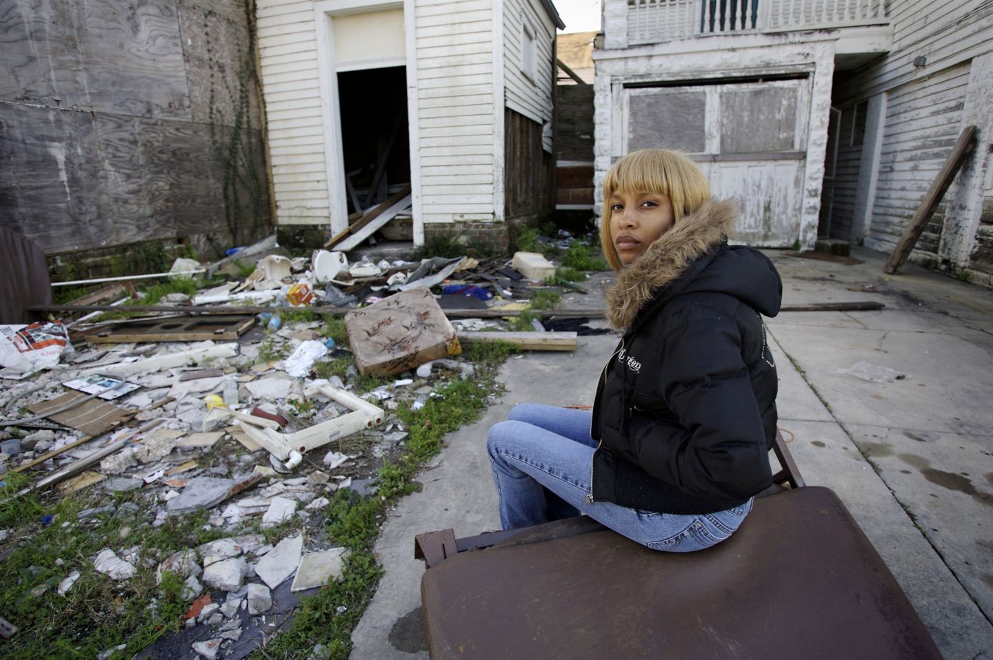
22-year old Tammy sits on a piece of junk on a derelict street. She was made homeless by Hurricane Katrina which hit New Orleans, Louisiana in August 2005. Credit: Panos / Robin Hammond. Though the debate is ongoing, it is widely accepted that temperatures had risen at the time and have continued to rise ever since, while hurricanes are intensified by warmer sea temperatures. At the same time, the destruction of the mangroves along the Gulf Coast and land subsidence have removed natural protections from storm surges. All this suggests that climate change and environmental pressures are likely to have increased the risk of a natural disaster such as Katrina. However, it is not just climate change that is the issue here, but also the social and economic disparities of New Orleans itself, with its minority populations among those worst affected because many were less likely to have the resources to adapt and more likely to be living in unsafe and more exposed conditions.
Minorities at risk
In the 1990s, disaster scholars drew attention to the fact that minority populations can be rendered more vulnerable than mainstream populations after a disaster and through this work led disaster research towards greater recognition of the social forces that could turn a natural hazard into a disaster. The catastrophic after-effects of Katrina illustrate this point. While few were untouched by Katrina – from the upper-class neighbourhoods of Uptown, to the artistic, ‘hipster’ areas of MidCity, to the projects of the Ninth Ward – pre-existing power relations around position in society, access to resources and distribution of income mean that some communities were less well placed to recover than others. Disasters can thus be seen as social events that reveal the inequalities, vulnerabilities and coping mechanisms that inform how people negotiate the ‘permanent disaster’ of daily life.
After Katrina hit the city, thousands fled to the Superdrome sports stadium where the authorities were meant to be providing protection, shelter, supplies and care. But they were completely underprepared and supplies, including fresh water, ran out in days. Where minority identities intersected, the impacts of Katrina were especially acute. Among African-American New Orleanians, for example, research showed that working-class identity and gender could exacerbate the impacts, with women at the centre of this intersection disproportionately affected by Katrina. This reality was explained through the fact that African-American women are more highly concentrated than any other demographic in services and sales, with already lower job security and wages than other areas of employment and in industries that were slow to recover post-Katrina. What are also revealed here are the implications of pre-existing inequalities faced by minority populations. To put this into context, around the time of Katrina, only 14 per cent of African- American women in New Orleans aged 25 and over had degrees, compared to 55 per cent among their white and Hispanic counterparts. This is despite the fact that over half the population in New Orleans is African-American.
Furthermore, some members of the Hispanic New Orleanian population faced the additional burden of documentation where their prior status was not legal. This prevented some segments of Latinx New Orleanians from being able to access vital resources and federal support, including access to temporary living space, food stamps and emergency funds. This situation persisted post-Katrina, when it was reported that many reconstruction workers were Latinx but employed on precarious contracts that meant they were not being properly paid and their labour exploited – a situation that was exacerbated when workers did not have of crucial documents to prove their visa status. There were also language barriers for those who were relatively new to the United States, making it difficult to negotiate ‘red tape’ such as complex form-filling.
The worst affected were those who were already vulnerable due to lack of access to resources to evacuate out of state and due to where in the city they lived, with poorer neighbourhoods situated on lower-lying ground, as well as how they were treated by officials in recovery and reconstruction. As indicated above, where minority identities intersected, the impacts of Katrina could be worsened: research has also shown that disabled people, elderly people, particularly women, linguistic minorities such as Cajun and Creole people, as well as indigenous peoples, faced a greater impact as a result of Katrina. For instance, while New Orleans is hailed as the ‘gay capital of the South’ and as such has a higher population of LGBTQ+ people, the state of Louisiana in general is not known for its tolerance to queer sexualities. Research by New Orleanian scholar Charlotte D’Ooge about lesbian women’s experience post-Katrina found that lesbian women struggled to gain access to relief services and found their relationships were not recognized by officials, demonstrating that lesbian identity and relationships placed them in a position of vulnerability and discrimination.
The effects of Katrina were exacerbated by the state’s failure to maintain infrastructure or address pre-existing inequalities. Had the investments been made to improve the levee systems, had a proper evacuation plan been in place, had the mangroves been restored, Katrina would never have happened the way it did. This reveals the complex intersection of climate change with institutional responsibility and, moreover, how inseparable institutional commitment to infrastructure is from climate environments, locally and globally.
Improving security in the context of a changing climate
While research on the connection between the increasing frequency and intensity of hurricanes and climate change is still ongoing, based on the available evidence there is good reason to be concerned about the implications of rising temperatures and other impacts for New Orleans and similarly exposed cities. With research indicating that hurricane intensity is deepening and little evidence that a suitable levee system is now in place, should another hurricane make its way to New Orleans it is very possible that the city will again experience disaster. Though better evacuation procedures are in place, in the event of further destruction it may not be possible for many people to return, and this does not account for those who are still not able to evacuate due to a lack of economic and social resources to do so.
This reflects not only the reality of a changing climate but also the limited commitment of the state to investing in adaptation infrastructure. Katrina occurred during the Bush administration, whose official line was to deny climate change, and as the violence and bloodshed of the Iraq con ict was escalating further. The so-called ‘war on terror’ took precedence over natural disaster public spending, which included the maintenance of infrastructure in a city that was home to a large population of minorities who were disproportionately affected as a result. At the same time, it should be highlighted that these vulnerable populations were and are much more than victims. In many cases, they have existing strategies and coping mechanisms in place that, with proper investment and support, could protect them and their communities from future shocks. The challenge, however, is implementation when access to resources and representation remains so restricted.
More fundamentally, the inequalities that shaped the way the disaster of Katrina unfolded in 2005 remain largely unchanged today, with New Orleans recently ranked as the second most unequal city in the country. These divisions, too, are still evident along ethnic lines, with incomes in 2016 of just US$25,800 among African- American households in New Orleans compared to US$64,400 for white households. Little research exists about further intersections among minority groups such as Creole, Cajun and Latinx peoples or queer communities. This is worrying, given that climate change research suggests that disasters will only intensify in future – and that minorities, as vulnerability scholars have highlighted, will be the worst affected.
Asia and Oceania
- 01
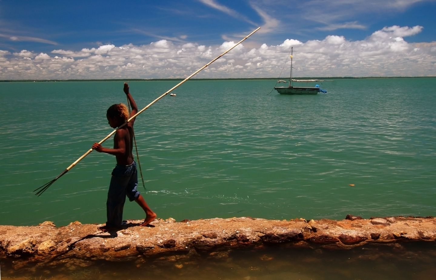
Australia: As the Great Barrier Reef shrinks, Torres Strait Islanders have everything to lose
By Jaume Rius Lopez The Melanesian Torres Strait Islanders have lived on the islands north of Queensland for at least 10,000 years and are closely related to the nearby Papuan people of Papua New Guinea. Because of their marginal location,…
0 min read
- 02
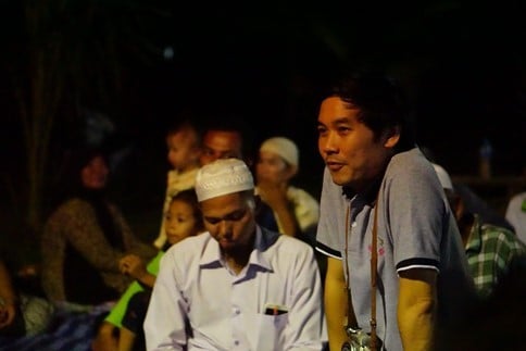
Thailand: For Thepa’s Pattani Bay community, a coal- red power plant could bring an entire way of life to an end – and in the process accelerate climate change across the planet
By Nicole Girard ‘Just living is not enough. I must have fresh air and freedom.’ Thepa protest sign Thepa is a small minority Muslim village in Thailand’s southern province of Songkhla, nestled in Pattani Bay. Its people rely…
0 min read
- 03
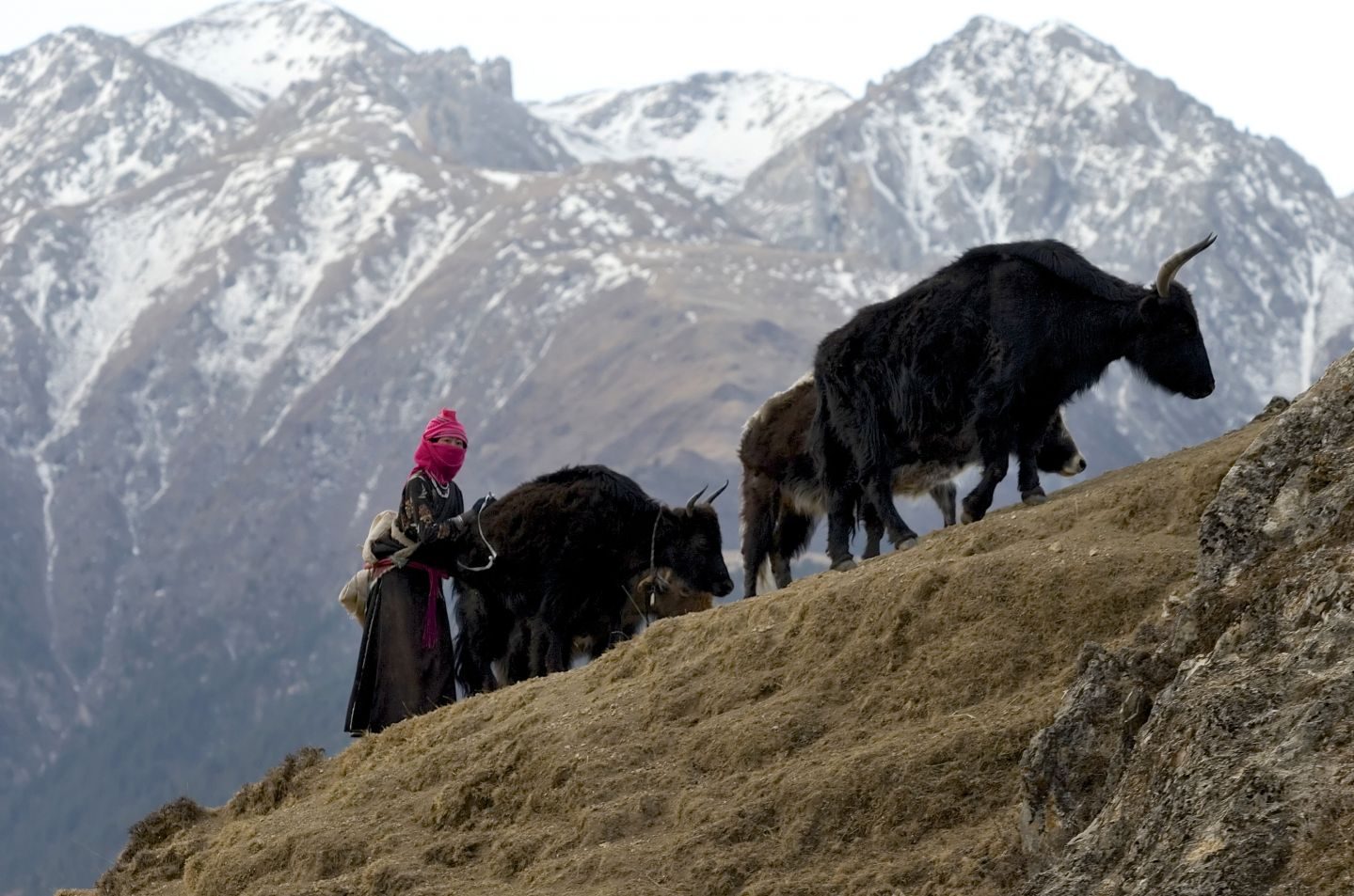
Tibet: Nomads caught between climate change and government ‘conservation’
By Gabriel Lafitte The impacts of climate change on the Tibetan Plateau – melting glaciers, river runoff, rising lakes and increasing rainfall – are well known. Yet the impacts on Tibetans themselves, numbering some 6 million people and…
0 min read
- 04
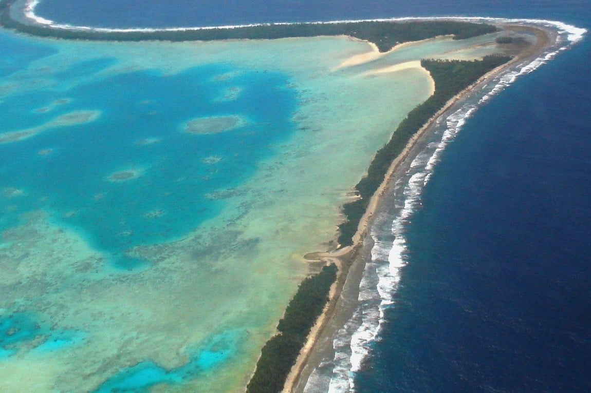
Tuvalu: ‘We have a right to stay in our God-given Islands’
By Soseala Tinilau Soseala Tinilau, besides serving as the Director of Environment in Tuvalu’s Ministry of Foreign Affairs, Trade, Tourism, Environment and Labour, is also President of the Tuvalu Islands Football Association (TIFA). In 2018,…
0 min read
- 05
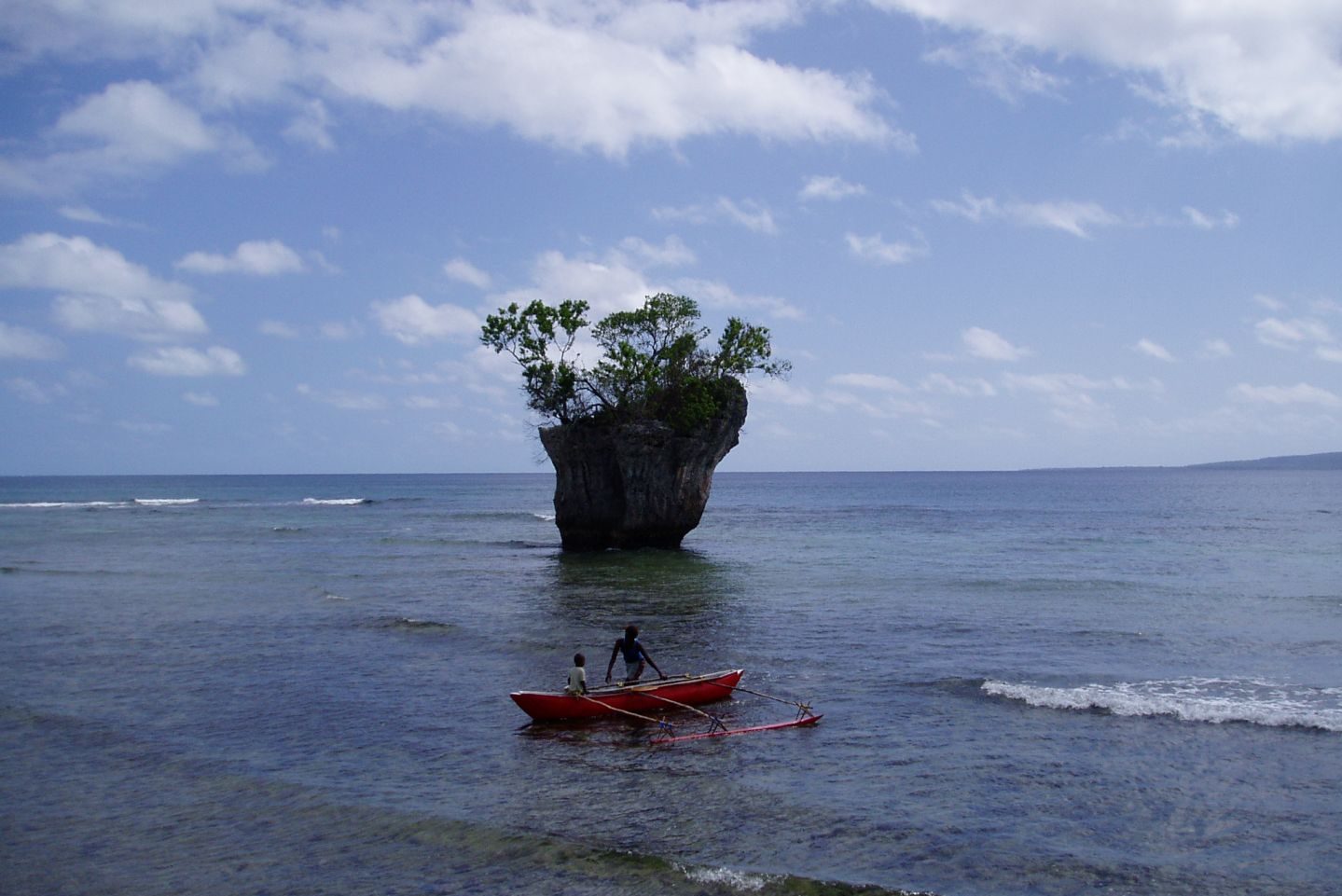
Vanuatu: Indigenous language loss and the multiplying effects of climate change
By Anastasia Riehl Rising from the deep waters of the South Pacific Ocean, an archipelago of erupting volcanos, bright blue inland marine holes, towering banyan forests and prolonged stretches of smooth sand beaches comprise the country of…
0 min read
-
By Jaume Rius Lopez
The Melanesian Torres Strait Islanders have lived on the islands north of Queensland for at least 10,000 years and are closely related to the nearby Papuan people of Papua New Guinea. Because of their marginal location, Torres Strait Islanders largely escaped the early excesses of European invasion and settlement until well into the nineteenth century, when a pearling and trading economy began to develop.
In the twentieth century, there was considerable migration to the Cape York peninsula on the mainland and to the large urban centres of Cairns, Townsville and Brisbane. Today there are approximately 32,500 Torres Strait Islanders in Australia and another 26,600 with both Aboriginal and Torres Strait Islander heritage. Approximately 7,000 people live in the Torres Strait, with just over 4,000 people residing in the Torres Strait Island Region, the main local government entity that was created in 2008. The majority are indigenous: nearly 65 per cent of the population in the Torres Strait Island Region are Torres Strait Islanders and just over 8 per cent are Australian Aborigines. The majority of the Torres Strait population is increasingly concentrated in the urban centre of Thursday Island. The inner islands just north of Cape York are the traditional home of the Kaurareg Aboriginal people.
Following a long campaign for recognition of their land rights, beginning in the early 1980s, in 1992 the High Court upheld the claim. There were also campaigns for self- government, driven in part by the perceived neglect of the federal and Queensland state governments, and greater powers were subsequently devolved to the Island Councils and the Torres Strait Regional Authority (TSRA), established in 1994.
A boy with a fish spear walks along an ineffective seawall on Saibai Island, Australia. Alamy / Suzanne Long. The contemporary economy is based on fishing, but much of the population is dependent on welfare services. Islanders have experienced discrimination and inadequate access to employment and services. Land issues have also posed problems. Compared to the rest of the country, Torres Strait Islanders continue to experience high levels of poverty and exclusion. For example, while in the country as a whole 31 per cent of homes are owned outright and only 30.9 per cent rented, on the Torres Strait Islands just 3.1 per cent are owned outright and the large majority (91.7 per cent) are rented. Together with Australia’s Aboriginal population, Torres Strait Islanders also face far poorer health outcomes, with a gap of almost 11 years in life expectancy between indigenous and non-indigenous Australians.
Now climate change is creating further challenges for the community. Rising sea levels, strong unpredictable winds, coastal erosion and high tides have become increasingly evident in the Torres Strait. In some areas, the impacts are already being acutely felt. In 2012, sacred sites and the cemetery on Saibai Island were flooded by very high tides. On Boigu Island, which is the northernmost community in Australia, the cemetery was threatened by ooding in July 2017 and sections of road washed away into the sea. These two islands are especially vulnerable and are facing inundation by high tides on an annual basis. The communities living on these islands are settled on smaller areas of land between the sea and swampy ground in the middle of the islands. Higher tides add to the water levels inland as well as along the seafronts. In February 2018, Yam Island was also hit, with king tides destroying houses and possessions, leaving families homeless. Salt water compounds the issues facing the communities, contaminating the groundwater and soil. Disasters like these will become increasingly commonplace in the years to come. According to the TSRA, sea levels are rising by between 6 and 8 mm every year, more than double the global average of 3.2 mm, in turn damaging the fragile marine and coastal ecosystems on which the way of life of thousands of Torrent Strait Islanders depends.
The heavy environmental toll of climate change is especially acute in the Great Barrier Reef. Torres Strait Islanders, together with Australian Aborigines, are the traditional owners of this unique natural asset, with much of their culture and traditional livelihoods built around its rich ecosystem. In the last few decades, however, its corals have been steadily dying. Recent estimates point to the alarming fact that the northern section of the Great Barrier Reef had already lost more than half of its coral cover since 2016. While pollution and an accompanying explosion in the number of star sh has contributed signi cantly to the reduction of the coral reef, bleaching from heatwaves is also a major factor – with climate change a major culprit in the increasing intensity of these extreme temperatures.
In combination with persistent coastal erosion and inundation, many island communities may eventually be forced to relocate unless signi cant investments in ood protection are made across the islands in the near future. Given the fundamental role that land and sea play in their identity, the impact of such a move on the wellbeing of Torres Strait Islanders could prove devastating. In the words of Getano Lui, deputy mayor of Torres Strait Island Regional Council: ‘What is instilled in us and our ancestors is if the Torres Strait sinks, we’ll sink with it.’
This profile is an edited version of the community profile featured in the Australia country entry of MRG’s World Directory of Minorities and Indigenous Peoples.
-
By Nicole Girard
‘Just living is not enough. I must have fresh air and freedom.’
Thepa protest sign
Thepa is a small minority Muslim village in Thailand’s southern province of Songkhla, nestled in Pattani Bay. Its people rely heavily for their livelihood on the sea and the coastline, with its mud ats and mangrove forests that are natural sh nurseries. Estuaries run from the Sankalakhiri mountain range, contributing to the bay’s rich biodiversity. Coconut, durian and watermelon groves supplement their fishery activities.
Thepa is part of the former sultanate of Patani that existed before it was annexed by the British to Thailand in 1902. It remains a contested zone to this day, where violence has simmered between those fighting for independence and the Thai state. Tensions run deep between the central Thai administration, relentless in the face of decades of failed assimilationist and centralizing policies, and the local Muslim populace.
When Thailand’s state-owned Electricity Generating Authority of Thailand (EGAT) proposed a coal- red power plant and nearby deep sea port in Thepa in 2014, the locals were immediately concerned. More than 200 families were set to be evicted with no clear plans for relocation or restitution, while mosques, Islamic schools, graveyards, houses and agricultural land were also located within the proposed area. Many were aware that such a project would not only destroy their community and way of life, but also lead to further violence from the independence movement and a heavy-handed response from Thai security forces.
Plans for the Thepa power plant, along with its twin plant in Krabi, are in stark contrast to the Thai administration’s international commitments, particularly those made in its Intended Nationally Determined Contribution (INDC), under the Paris Agreement. A report, submitted in 2016, notes that as ‘a developing country highly vulnerable to the impacts of climate change,’ it intended to ‘reduce its greenhouse gas emissions by 20 per cent from the projected business-as- usual (BAU) level by 2030.’ Nothing is mentioned, however, about its plans to build coal-red power plants in pristine coastal areas.
‘The Thai government always has two-faced politics’, explains Dr. Supat Hasuwannakit, director of Green South Foundation (GSF), a local environmental civil society organization (CSO), and doctor at the nearby Chana Hospital for the last 20 years. ‘One face is a strong country moving toward Sustainable Development Goal (SDG) commitments in the international platform; the other is at national platforms, where the Thai government is always reluctant to work hard toward their commitments because industrial groups are strong in Thailand. They have a very close relationship, so it is not easy to reduce CO2 and greenhouse gases to implement their climate commitments.’
The planned 2,200-Megawatt (MW) Thepa plant will be constructed in an area of 4.5 square kilometres and is just one of a total of six new coal- red electricity-generating plants proposed by EGAT to be completed by 2025. EGAT governor Kornrasit Pakchotanon asserted that EGAT needed to be the market leader and the power plants were the means by which to achieve this goal.
Despite the signi cant risks this development posed to local communities whose culture and livelihoods depended on the sea, consultations with residents were deeply awed. An Environmental Health Impact Assessment (EHIA) was privately commissioned by EGAT in 2014. Community members who opposed the project were not allowed to participate in the public review. Coils of razor wire surrounded the venue for the hearing, and the governor of Songkhla province sent 1,500 troops and police to prevent any villagers opposed to the project from gaining access. The junta administration even issued an order with the intention of speeding up construction by removing certain procedural safeguards and checks.
GSF, along with a local community group known as the Network of Songkhla-Pattani People Against Coal, initiated a sustained non-violent community resistance campaign. A series of monthly forums were held to increase public solidarity, increase community knowledge relating to the power plant and climate change impacts and give training to community teams that would assist with community-led EHIAs. Bringing together a wide range of different groups, including women and youth, the wider network began organizing peaceful protests, with demonstrators dressed in green calling for an immediate halt to the power plant. In December 2017, following continued repression by Thai authorities to prevent public gatherings, 17 activists were arrested and charged with violating this junta order.
In February 2018, community members continued their resistance with protests in Bangkok, organizing outside the Government House and subsequently undertaking hunger strikes. In response, the Ministry of Energy announced that plans for the Thepa and Krabi plants would be postponed for three years. Shortly afterwards, the ministry signed an agreement to undertake a Strategic Environmental Assessment (SEA) to assess the appropriateness of coal- red power in southern Thailand. GSF continued to pressure the Ministry of Energy to ensure that the government body responsible for the SEA would not be one that is aligned with the pro- coal movement. The National Institute of Development Administration (NIDA) is now responsible for the study.
GSF and the wider anti-coal network are collaborating with the SEA process and support the selection of NIDA, which they believe will approach the study from a neutral standpoint. Following public hearings in April and May, the process is set to be completed by August 2019 – a timeframe that some community activists consider rushed. While the postponement of the project was a short-term victory for the coal resistance movement, many doubt that the project will be shelved entirely. According to Hasuwannakit, ‘we’re still not convinced that plans for southern coal are really gone since the SEA process is still ongoing, plus southern coal is also in the 20-year National Strategy Plan by the government.
Moreover, the Energy Ministry plans to bid out 8.3GW of new independent power plants (IPPs) which in international news they mention using coal as fuel but in Thai news, they don’t mention coal.’ For activists with experience in challenging state- imposed development projects in the region, this lack of transparency raises serious concerns.
Importantly, while rooted in resistance to the clear and immediate danger that the plant poses to the health, livelihoods and wellbeing of the local community, the protests have evolved to take on the larger consideration of climate change at a national and global level, with the certain damage that further coal plant construction would bring through added CO2 emissions giving an added impetus to activists and demonstrators. ‘The locals,’ says Hasuwannakit, ‘know very well about the negative impact of the coal- red power plant to their community. Yet they also now understand the connection to climate change at a basic level. They are proud that their Thepa group is part of the global movement fighting climate change.’
-
By Gabriel Lafitte
The impacts of climate change on the Tibetan Plateau – melting glaciers, river runoff, rising lakes and increasing rainfall – are well known. Yet the impacts on Tibetans themselves, numbering some 6 million people and occupying almost 2 per cent of the planet’s land, attract far less attention. Instead the focus is almost entirely geopolitical, on global impacts and global responses: actual Tibetan land managers are absent, even though they make land-use decisions daily in a climate that has always been highly variable, requiring great skill in living with uncertainty.
First, the bigger picture. The glacial sources of Asia’s great rivers, at 6,000 to 8,000 metres above sea level, overlooking the vast Tibetan Plateau, are melting fast. Despite some initial confusion within the Intergovernmental Panel on Climate Change (IPCC) as to the likely rate of ice loss, there is now no disputing the accelerating mass imbalance. Similarly, the overtopping of the lakes and heightened river flows are by now all well documented, especially in Chinese scientific publications.
This is where the consensus stops. Although Tibet is the most inhabited of cryospheres, it is also out of bounds to international media and human rights activists. As a result, the experiences of local communities at the frontline of climate change are neither heard nor acknowledged. In the absence of Tibetan voices, the significance of rapid warming is argued by states, scientists and geoengineers, all seeking global results.
For China, short of water for industry, agribusiness and urbanization, increased runoff is a dividend; likewise the prospect of a coming climate more able to support crops and forest species familiar to lowland China. Water provision from Tibet has become the top priority for China’s central planners, resulting in the zoning of prime grassland landscapes as national parks from which most Tibetan pastoralists are excluded, in the name of guaranteeing water retention and downstream provision. This is part of the Chinese government’s strategy to control the hundreds of thousands of square kilometres of alpine meadow between the glaciers and lowland China, which the Yellow and Yangtze Rivers ow through. Ultimately, the official policy is to return huge areas to their original, pristine state as grassland wilderness, ignoring millennia of landscape curation by nomadic herders.
China’s dividend of increased river flows due to glacier melt will turn to de cit when the glaciers are gone. That will take most of this century, it seems, far away enough for little immediate concern, and perhaps compensated for by increasing precipitation. For thousands of years, lake levels across Tibet have been slowly falling, as monsoon rains reaching into Tibet from the Bay of Bengal through the Himalayas have steadily reduced in intensity. Now, especially in the land of lakes of northern Tibet, that trend has reversed. The summer of 2018 was one of the wettest known in Tibet, and Chinese scientists now worry about lakes breaking their banks and flooding far below.
China’s water dividend from Tibet will be locked in legislatively in 2020, when a chain of national parks will be formally launched, including the Sanjiangyuan, or Three-River Source National Nature Reserve, in which all human presence, from mineral extraction to nomadic pastoralism, is categorized as a threat to be excluded. Further enhancement of the water dividend is planned by geoengineers who propose cloud seeding the Sanjiangyuan catchment, triggering precipitation by ring rockets laden with silver iodide at monsoon clouds drifting in from distant oceans. However, it is far from certain that the enthusiasts for geo-engineering, on a scale never seen before, can demonstrate that their technologies are effective, especially at a time when rain is already increasing due to climate change.
Beyond China, glacier melt generates much alarm, yet so far little attention has been paid to the Tibetan lives and livelihoods being removed and shut out in the name of climate change adaptation. China’s desire to recreate ‘original ecology’ in depopulated Tibetan landscapes is explicitly intended to grow more grass and increase biomass by excluding grazing animals, thus capturing carbon and in the process earning China – the planet’s biggest emitter of carbon – accolades and global carbon credits.
Minority and indigenous populations worldwide face pressure from ranchers and plantation growers who want their land, but seldom on such a scale, and in the name not of palm oil and beef but of climate change mitigation. Conservationists who would be expected to welcome a declaration of protected areas will, in 2020, have to carefully consider the declaration of the Sanjiang, Qilian and Panda National Parks, and the exclusion of local Tibetan customary guardians from their lands.
On the ground in Tibet, for both pastoralists and crop-growing farmers, climate change affects everything. Much of the Tibetan Plateau – an area the size of Western Europe – is a permafrost zone, but the permafrost itself is now melting fast, which not only releases methane into the atmosphere but also drains away frozen soil water into the deeper earth, beyond the reach of young grasses and sown crops. The early arrival of spring, months before the summer rains arrive, is now a problematic period, with temperatures suited to growth but on lands that have not in the past required irrigation.
Permafrost melt greatly affects the many wetlands of Tibet, drying them out in spring before the summer rains arrive, in the process compromising habitat for migratory species. As in many areas worldwide, the climate change trend is for more extreme weather. In Tibet, long prone to intense gales and blizzards, this means more sudden hailstorms destroying the ripening crops of barley farmers, and more livestock herds trapped behind snowed-in high passes, perishing because they cannot reach lower grazing grounds. China does not provide insurance schemes for such disasters, relying instead on relief campaigns led by cadres. Meanwhile, in Tibet’s wetter and warmer south-east, habitats change as one ascends any mountain, from subtropical to alpine, on a single slope, creating many habitats suited to varied species of plants and animals. As the climate is warming rapidly, however, there is not enough time for them to adapt and go upslope.
In many Tibetan areas, official policy changes require dryland upland farmers to convert much of their farmland to trees, or to close farms altogether, without effective reforestation. This is known as ‘grain to green’ and the ‘sloping land conversion program’. China has not employed local Tibetan communities to re-forest areas logged intensively for decades. Young trees on exposed slopes, lacking the protective canopy cover of older trees, are extremely vulnerable to frosts. All of this exacerbates the precariousness of Tibetan lives, with Tibetan children already prone to undernourishment.
Tibetans who speak publicly of such issues are seldom tolerated in a highly centralized system where only ofofcial voices are permitted. Although Tibetan non-governmental organizations (NGOs) have discreetly worked to help local communities adapt to climate change, high-profile environmentalists are criminalized and imprisoned. This effectively removes Tibetans from the public sphere, excluding them from any opportunity to shape climate policy.
The end of the pastoralist mode of food production and land-use management in Tibet is in sight. As climate change becomes a core rationale for depopulating rural Tibet, displaced pastoralists – recast in official discourse as voluntary ‘ecological migrants’ – are now resettling in urban fringe settlements. Climate change, and the Chinese government’s response, privileging grass and water over customary livelihoods, may soon succeed in closing huge areas to productive use, ending a strategy that has made Tibet habitable for thousands of years.
The mobility of Tibetan pastoralists, always moving on to avoid exhausting pastures, was in itself a response to an unpredictable climate. That mobility, long regarded with suspicion by China as primitive and uncivilized, has been forcibly restricted through successive strategies, first by compulsory collectivization, then by allocating land tenure to individual families while preventing customary seasonal rotations. With compulsory fencing and enforced stocking ratios further undermining the traditional pastoralist system, increasing blame has been heaped by the state on nomadic communities as the shrinking land allocations available to them have become insufficient to sustain their herds. This vicious circle is now approaching its final spiral. From beginning to end, nomadic lifestyles and the Chinese government’s policies have been driven by differing approaches to climate change. Tibetan pastoralists are now being cleared from their land in the name of environmental conservation, overlooking centuries of accumulated skill and wisdom in managing the vast and challenging space of the Tibetan Plateau.
Photo: A Tibetan nomad walks her yaks up a hill. Credit: Panos / Kieran Dodds.
-
By Soseala Tinilau
Soseala Tinilau, besides serving as the Director of Environment in Tuvalu’s Ministry of Foreign Affairs, Trade, Tourism, Environment and Labour, is also President of the Tuvalu Islands Football Association (TIFA). In 2018, as he explains to MRG, the Tuvalu team performed in the Confederation of Independent Football Associations (CONIFA)’s World Cup – an opportunity that was used not only to showcase the country’s football skills but also the challenges posed by climate change.
Climate change has impacted on Tuvalu and its inhabitants due to its resource-poor, low-lying, fragile and remote physical nature. These are some of the environmental effects I have noticed:
- Constant seawater inundation, which has caused severe damage to Tuvalu’s only staple crop, threatening our food supply.
- Sea level rise, especially during king tides, inundating most low-lying areas of the islands including the airstrip, affecting people’s daily travel.
- Increasingly intense cyclones like Tropical Cyclone Pam in 2015, which severely damaged crops, houses, hospitals and livestock. It completely wiped out three uninhabited islets which people depend on for rewood, food and shelter.
- Severe erosion of beachfronts, especially on the western sides of the islands, which triggers quarrels among land owners.
- Severe droughts which brought the country to its knees as most families were without water.
- Decreasing reef resources due to rising sea temperature, contributing to coral bleaching.
My motivation for drawing attention to climate change during our participation in the 2018 CONIFA World Cup is due to the fact that we were representing Tuvalu and because of the issues we faced back home. Even with these uncertainties, we can become resilient if we work together to adapt to the adverse impacts of climate change, and we can use football as a tool for advocacy. As you know, football is the beautiful game, and more people can relate themselves to this.
I made appointments especially with sportswriters and television stations to be interviewed during the games, and that’s where I mentioned the plight of our country due to the adverse impacts of climate change and asked the audience to help reduce their emissions, because a small act goes a long way. We have a right to stay in our God-given islands.
I wish to see countries, especially those who are parties to the Paris Agreement, do their fair share and expedite the implementation of the Paris Agreement, increase their National Determined Contributions to reduce emissions and to make the transition to renewable energy.
Soseala Tinilau stands outside the office of the Permanent Mission of Tuvalu to the United Nations. Photo supplied by Soseala Tinilau. -
By Anastasia Riehl
Rising from the deep waters of the South Pacific Ocean, an archipelago of erupting volcanos, bright blue inland marine holes, towering banyan forests and prolonged stretches of smooth sand beaches comprise the country of Vanuatu. These diverse landscapes, spread over 80 islands, have fostered a rich array of life – not only of plants and animals, but also of peoples and cultures. Dozens of distinct communities practising unique traditions and speaking different languages thrive throughout these islands.
The country’s geography, which has gifted this diversity, is both its blessing and its curse; Vanuatu has the privilege of being the country with the most indigenous languages per capita, alongside the misfortune of being one of those most immediately at risk from climate change. These islands offer a window into one of the lesser- discussed threats of our changing climate: the threat to indigenous languages and global linguistic diversity.
Today the world is rich with languages – approximately 7,000 of them. But as the days pass, the numbers fall. Language scholars broadly agree that within the next 100 years, more than half of the world’s languages will have gone extinct (meaning that no native speaker of a language remains). This decline has already begun, and news stories regularly mourn the passing of a ‘last speaker’. There are many causes of this loss. Governments typically support national languages over regional languages in education and media. Persecuted groups face pressure to abandon minority and indigenous languages. Global conflicts lead to the splintering of linguistic communities during refugee crises. Technological advances in communication and transportation facilitate interaction between formerly distant communities. Globalization necessitates the use of large international languages for political and economic purposes. Now add to this list a new and exacerbating factor: climate change. As climate change threatens the sustainability of indigenous communities throughout the globe, it also threatens their languages – languages that are already struggling to survive.
Climate change will ultimately affect all countries and peoples in the world. The most immediate and extreme effects, however, will be felt by tropical island states, which are particularly vulnerable to the rise of sea levels, warming ocean temperatures and increasingly destructive cyclones. Plans for relocating communities displaced by climate change are either under way or being discussed for the Maldives in the Indian Ocean and for low-lying coral atolls in the Paci c such as Kiribati, Tuvalu and the Marshall Islands. These areas of the world are disproportionately rich in indigenous languages, as each small island or nation is typically home to one or more distinct languages or dialects. As people are forced to leave their lands and relocate to other communities, they must adapt to new languages, and maintaining their own indigenous languages is a significant challenge.
Vanuatu is one of these states at the forefront of climate vulnerability. In 2015, the country was devastated by Cyclone Pam, a category 5 tropical cyclone cited as one of Vanuatu’s worst environmental disasters of all time, which completely destroyed the infrastructure of many villages and severely affected the nation’s economy. While environmental hazards such as cyclones and floods, as well as tectonic activity like earthquakes and volcanic eruptions, have long been part of life for the people of these islands, there is increasing evidence that climate change may be contributing to the intensity and frequency of such events. The grave injustice is that Vanuatu, whose people live mostly in self-sustaining villages and produce very few fossil fuels, did not create this climate change disaster yet will be among its earliest and most deeply affected victims. In 2018, Vanuatu’s Foreign Minister Ralph Regenvanu announced that the country would be the first to explore legal means to ‘shift the costs of climate protection back onto the fossil fuel companies, the financial institutions and the governments that actively and knowingly created this existential threat to my country.’
This existential threat extends to the country’s languages. Vanuatu is home to over 100 indigenous languages, from the 900 speakers of Aneityum at the southernmost tip to the 250 speakers of Hiu at the northernmost. With such a large number of languages and a total population of only 270,000 people, Vanuatu is believed to be the most linguistically diverse country on Earth. These languages have had the good fortune to thrive in a country that embraces, rather than suppresses, indigenous identities. The island state is rather unusual in its support of its languages: the government formally recognizes the indigenous languages in its charter and supports mother tongue language programming in elementary schools. These efforts reflect a more general movement to respect, celebrate and maintain indigenous cultural practices. But these efforts are in a battle against the myriad of stressors taking aim at the country’s languages.
Vanuatu’s languages exist in a linguistically complex environment. The country has three official languages: English, French and Bislama. The first two, left by colonial powers Britain and France, who jointly governed the country until independence in 1980, remain the primary languages of education and business and are imperative for anyone seeking opportunities outside the country. The third official language, Bislama, is a creole based on grammatical structures from local Melanesian languages but with vocabulary primarily from English. It arose during the 1880s when Vanuatu’s people were forced to work on plantations in Australia and Fiji. Bislama now serves as a lingua franca and is spoken by almost everyone as a second language and increasingly as a first language for those in the capital city, Port Vila, and those from linguistically mixed families.
Encouraging the use of the official languages, particularly Bislama, are developments in communication and transportation. A mobile phone network, launched just over 10 years ago, now connects islands that never had landline capabilities, and a new ring road on the main island of Efate greatly eases movement between communities previously accessible to one another only by boat or long treks on foot. (The road was just recently reopened after repairs following the destruction of Cyclone Pam.) While most would agree that these developments are positive for the country, they come at the cost of placing additional strain on its indigenous languages.
Now climate change is exacerbating these effects, threatening to destabilize the foundation that has bolstered Vanuatu’s indigenous languages for centuries – traditional village life. Spread over dozens of islands, across disparate pieces of coastline, separated from one another by a wide river, a steep interior or the ocean waters, a number of relatively isolated indigenous communities have developed. These communities have thrived for centuries thanks to a climate that supports abundant resources – forests filled with fruit trees and edible plants, vast sh stocks and rich soils for subsistence farming. This sustainability has helped earn the country a ‘world’s happiest’ ranking in international surveys of wellbeing.
In these villages, without reliance on outside interactions, distinct indigenous languages and cultures have flourished. Now, however, as coastal areas become uninhabitable and weather changes adversely affect farming and fishing, some communities will be forced to relocate. This movement will bring different linguistic groups closer together in the fewer habitable areas and increase the number of people moving to Port Vila, environments that foster use of Bislama and decrease use of the indigenous languages.
Language loss may not seem as significant as the other losses Vanuatu and the world face in a changing climate, but it is far from solely a sentimental one. Languages are foundational to identity, the principal means for conveying a community’s culture and heritage.
This is why indigenous communities in North America, rebuilding their societies after decades of persecution, are prioritizing language revitalization alongside efforts to improve education and health care. Languages are also an invaluable source of information about the brain: loss of a language before it has been documented is a loss of scientific data needed to understand cognition, and, sadly, most endangered languages have yet to be studied or recorded. Finally, languages encode information about the natural world: the dozens of types of vines twisting into the trees on the Vanuatu island of Malakula, referred to by their thickness, rate of growth and distance from the ocean, have names in the local Na’ahai language but not in Bislama, and likely not in any other language.
Change is coming to the world’s languages. Many will not survive the great shifts ahead, while others will persevere against the odds.
For communities dedicated to preserving their languages, the right planning and resources will help them succeed. Unfortunately, climate change’s multiplying effects shorten the timeframe and rob them of the necessary resources, making the challenge that much greater. Among the many critical reasons that humanity must fight to mitigate the looming climate crisis is the need to save the languages of Vanuatu and the linguistic diversity of the planet.
Photo: Members of a coastal community on their boat in front of an outcrop in Vanuatu. Photo supplied by Anastasia Riehl.
Europe
- 01
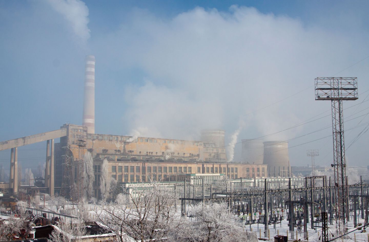
Bulgaria: The Roma community that got trapped in a coal pit
By Vesselina Foteva Bulgaria’s Roma population, one of the largest per capita in Europe, is among the country’s most marginalized communities and Roma frequently experience unemployment, social exclusion and economic exploitation. Bulgaria…
0 min read
- 02

Finland: ‘Instability and abnormality are the new normal. Weather can change in an instant’
By Klemetti Näkkäläjärvi Klemetti Näkkäläjärvi, a Sámi researcher and member of the Galggojávri Sámi reindeer-herding community, has worked for years on the impact of climate change on the Sámi people. Here he explains…
0 min read
- 03
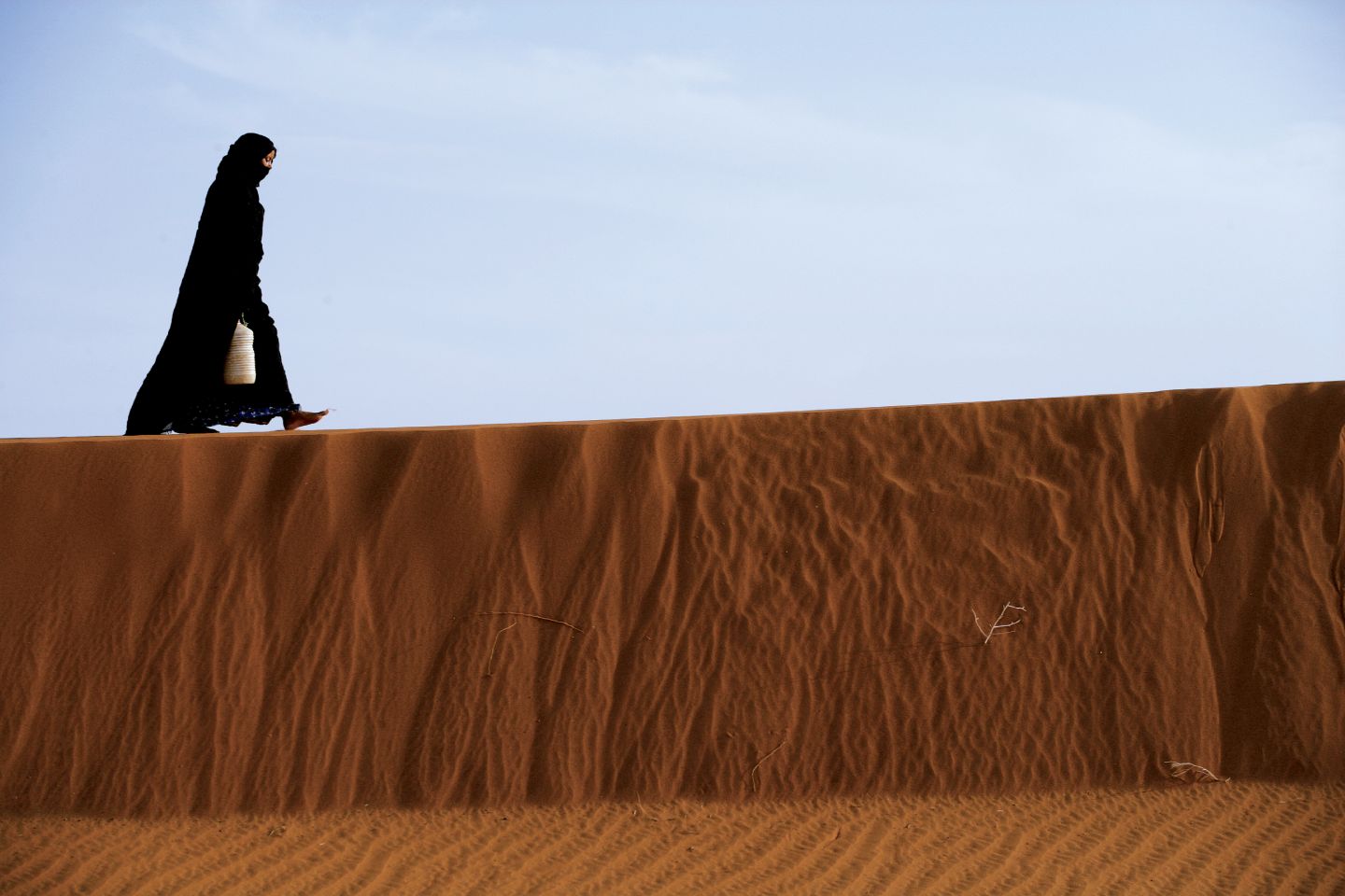
Poland: The role of environmental factors in shaping migration from Maghreb countries to Europe
By Karolina Sobczak-Szelc Algeria, Morocco and Tunisia have a long history of migration to Europe. The destinations have changed over time: while France, Belgium and the Netherlands were major targets at first, later North Mediterranean…
1 min read
- 04
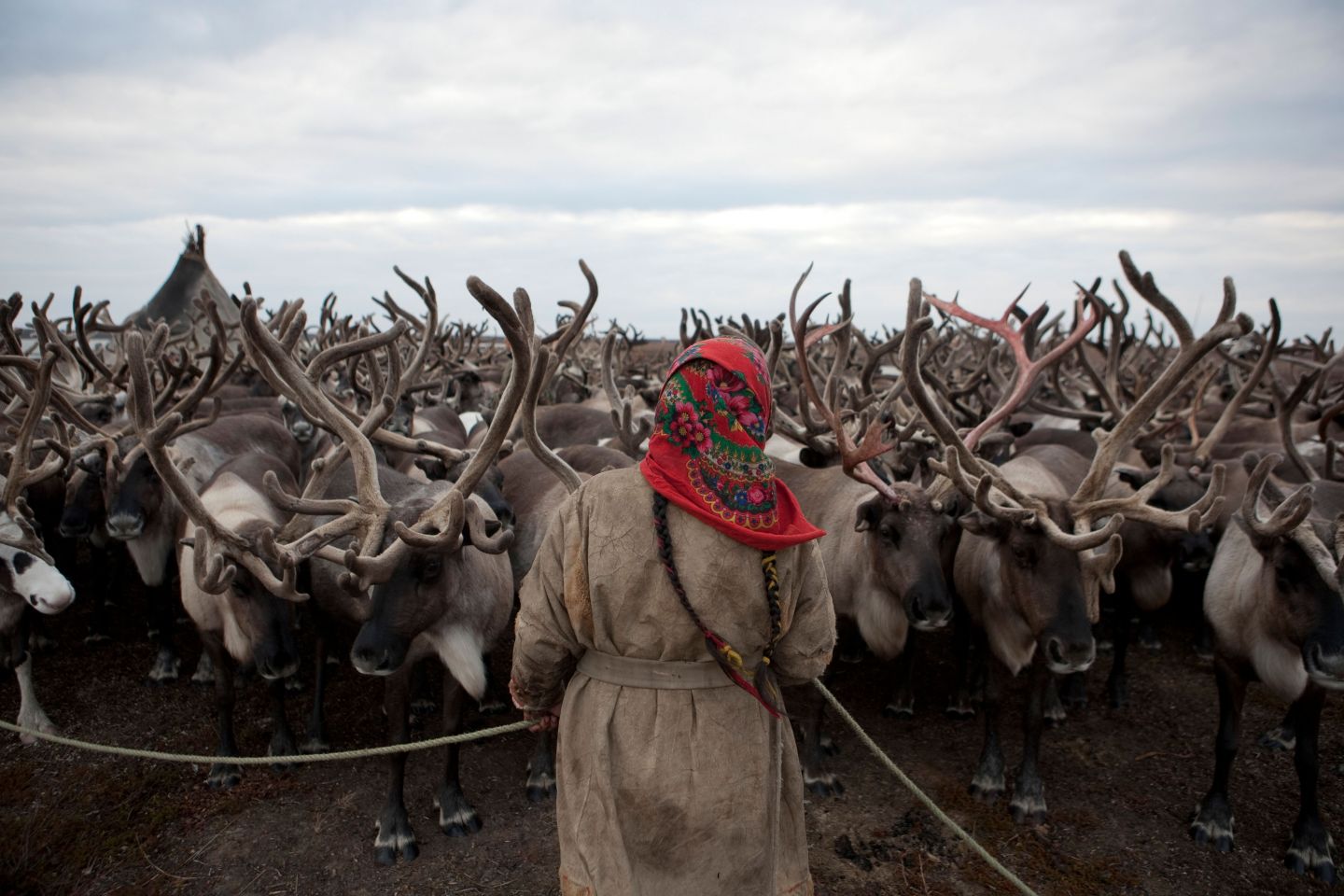
Russia: A way of life under threat for Nenets as oil drilling and ice melt take their toll
By Charlotte Graham Nenets are an indigenous Siberian people, whose traditional economy has long been rooted in nomadic reindeer-herding, fishing and hunting. The majority inhabit the Yamal Peninsula – meaning ‘edge of the world’ in the…
1 min read
-
By Vesselina Foteva
Bulgaria’s Roma population, one of the largest per capita in Europe, is among the country’s most marginalized communities and Roma frequently experience unemployment, social exclusion and economic exploitation. Bulgaria also has one of the highest levels of air pollution, with elevated levels of fine particulate matter from burning coal and waste – a practice on which much of its electricity industry depends.
In 2017, Bulgaria became the first European country to lose a case in the European Court of Justice for its particularly poor air quality, and pollution continues to take a heavy toll on human health and the environment.
These two issues converge in the Bulgarian town of Pernik. Pernik is a town in western Bulgaria with a population of about 80,000 people, located 40 kilometres from the capital city of So a. According to official data, the Roma population in Pernik is around 3,500 people, but even the municipality of Pernik contests this figure: in reality, though the exact number is unknown, the community is much larger.
At the beginning of the last century, following the discovery of large deposits of brown coal in the area, the town became an industrial hub. Monumental slogans like ‘Glory to the Labour of the Pitman’ can be seen everywhere in town, and many in Pernik still proudly argue that So a was chosen as the capital city only because of its relative proximity to the natural riches of the ‘Black Gold Town’. Today, though, the splendour of this jewel of Bulgaria’s mining industry shines no more. The tens of kilometres of tunnels, which cover roughly two-thirds of the area of the town, are all closed, and only one open-pit mine is still in operation.
Unofficially, though, the mining goes on. In the last decade, there have been regular reports of illegal coal mining – and those typically suspected and frequently referred to in local media as ‘moles’ are Roma. What is usually left out of this analysis, however, is the poverty and exploitation that has driven a small number of community members to engage in this dangerous practice, and the fact that those worst affected are overwhelmingly Roma.
Roma and illegal mining
‘Horror houses: Illegal mining destroys houses in Pernik’
’16 arrested for illegal coal mining near Pernik’
‘Illegal coal mining leads to a landslide in Rudnichar in Pernik’
This is how the media reports on the increasing prevalence of illegal coal mining in old and abandoned mines near Pernik. Those arrested are usually Roma or sometimes former coal miners looking for some additional income.
‘Near Ursata natural park is located the now closed mine owned by the Bulgarian–Belgian company Recoal, which is still operating, but illegally. The local institutions were turning a blind eye, so that there would be some livelihood for the minorities’, says Genadi Kondarev, coordinator for Social Funding for Sustainable Development with the non-governmental organization (NGO) For the Earth. He has been fighting against climate change and illegal coal mining for years.
Ursata natural park is a forest that was supposed to separate Pernik from the open-pit mine just outside the town. In 2005, however, Recoal won a concession and started mining right in the centre of the forest. In 2015, when the contract ended, Recoal failed to fulfil its obligation to re-forest what it had destroyed. The inhabitants of the mostly Roma settlement nearby, known as Rudnichar, are still feeling the after-effects of this.
‘There are 300 unsecured shafts, horizontal galleries and excavations deeper than 20 metres,’ says Kondarev. ‘They are being used even today by people, including young children, to mine coal.’ At rst the mining was for personal use only, but over time it became more organized and the coal is now being sold on the black market for as little as a tenth of its market value. And on the mining went, until eventually three houses in the settlement collapsed.
And though the ‘moles’ themselves live in Rudnichar, Kondarev reports that ‘it is hard to talk with them’ as many now fear losing their income and prosecution for their activities.
A community sickened by mining
The Roma community in Rudnichar prefers not to talk about the illegal mining, but a short walk through the unpaved streets of the neighbourhood shows that almost every house has some coal near the front door and there are lots of small warehouses. Nobody hides the issues created by the now closed mine of Recoal.
The walls of Maria’s house (the names of all Roma community members have been changed) are cracked because of the landslides, but she has not left it. ‘Everyone does what they can in order to get some food on the table here. Sixty years I’ve lived here, practically since I was born. It was really nice here. Now it’s decaying. They cut down the forest. Dug, dug, the rich people, got the coal, took the money, and left. It’s scary when you think about it.’ She used to let her children play in the forest, but now doesn’t allow her grandchildren even close to it. ‘How can I let them go there? It’s a swamp, a hole, a wasteland!’
‘The Belgian guy was a troublemaker!’ adds her neighbour, Alexander. ‘His baggers dug here, then left it in ruins. I let the children play only in front of the door, you can’t let them go farther!’ But when asked about the local ‘moles’, he says that he does not know any and walks on.
Another resident talks more openly. ‘In the night, they use lights to dig. The police tried really hard to stop this, but failed. It’s not a joke at all – 13 people got buried in the ground. They mine to sell, not for personal use. This is fast money, but who knows – one night you go back home, but the next you might be left underground.’
Kondarev has been reporting on the issue for years. The diggers don’t understand how they influence their own communities, but he thinks that the Roma people are being exploited. So far, unofficial estimates suggest that there may have been more than a dozen deaths as a result of accidents from illegal mining, but ‘there is not even any official data on that’. Recoal’s failure to re-forest the area has enabled continued mining and other illegal activities, such as logging, that in turn have resulted in landslides, flooding and adverse effects on the health of the inhabitants themselves. ‘The big money players use the people. For them, the people, they don’t mean anything, their life is worthless. They just send them, give them a few dimes for every sack of coal, and whoever goes out of the ground is out. Whoever doesn’t – doesn’t.’
The big picture
The illegal coal mining near Pernik turns out to be part of a bigger problem – one that, while attracting criticism from a variety of health and environmental organizations, appears largely to be accepted by Bulgaria’s government and industry. Coal fuels an industry that has been widely accepted as harmful to the environment and a major contributor not only to air pollution, but also to climate change. In Bulgaria there are eight coal-fuelled power plants currently in operation, including the Republika power plant in Pernik, and coal burning – responsible for a third of the country’s CO2 emissions – generates more than 40 per cent of the nation’s electricity.
Coal is largely responsible for the extraordinarily high levels of fine particulate matter in Bulgaria, a major cause of respiratory diseases with deadly implications. The World Health Organization (WHO) has cautioned that the country has the third highest mortality caused by air pollution in the world, after only North Korea and Bosnia and Herzegovina, and has called for immediate measures from the Bulgarian government.
In addition, the European Environment Agency reported in 2013 that four of the five most air-polluted European cities were located in Bulgaria, with Pernik topping the list – a situation reflected in research by advocacy groups such as the ‘Pernik Breathes’ Association. ‘We have mobile measuring stations which we have placed in our homes to examine the air quality before we open the windows,’ says Ivaylo Velinov, a member of the association. ‘With the start of the winter the air gets unbreathable.’
Although Bulgaria is one of the many countries that adopted the Paris Agreement, business continues as usual in the municipality of Pernik. Climate change activists warn that the municipality has received four investment proposals to support the burning of more than a hundred different types of waste to generate electricity. If implemented, this would likely worsen the air significantly. And, at a broader level, while a growing number of countries proudly declare their deadlines for the cessation of coal mining and its use for energy production, Bulgaria has demonstrated no intention of shifting to a cleaner energy source. This is reflected in the statement of the President of Bulgaria, Rumen Radev, at the UN Climate Change Conference in Katowice, Poland in December 2018. ‘We strongly disagree with the unnecessarily high requirements for the reduction of greenhouse gas emissions,’ he said then. ‘We must keep coal mines in Bulgaria because this means keeping jobs and guaranteeing security.’
The cracked house belonging to Maria in the neighbourhood of Rudnichar in Pernik, Bulgaria. Photo supplied by Vesselina Foteva. Ignoring the consequences of climate change by focusing on the economic security of the community – despite the fact that the WHO estimates the cost of air pollution to Bulgaria from premature deaths at 29.5 per cent of its national GDP – is a well-proven tool for shifting the topic, skilfully used by the local authorities as well. They tolerate the thriving black market for coal by imposing only nominal control over the restoration of the many abandoned mines. In addition, those residents involved in illegal mining are rarely sanctioned effectively for their actions, or offered the opportunity to engage in alternative livelihoods. Instead, the illegally mined coal is left to infiltrate seamlessly into the local economy. What is needed instead is a transformative strategy, founded on climate justice, to navigate the country towards a greener and more equitable future. This would bring significant benefits to all Bulgarians and prevent many of the more than 15,000 premature deaths that currently occur in the country every year as a result of air pollution. Beyond that, however, there needs to be greater recognition of the poverty and discrimination that has locked marginalized communities such as Rudnichar’s Roma in a vicious cycle of contamination, exploitation and ill health. While stronger regulations would go a long way to protecting them from the worst effects of the illegal mining, authorities also need to invest in providing residents with better opportunities elsewhere. Until the underlying barriers separating Roma communities from other Bulgarians are addressed, it is likely they will continue to find themselves on the frontline of the country’s ongoing environmental crisis.
All names of members of the Roma community have been changed at their request. Contacts with the local Roma community were established with the kind support of the ‘PULSE’ Foundation.
Top photo: Smoke and vapor rise from chimney and cooling towers of the coal- red thermal power plant ‘Republika’, in Pernik, Bulgaria. Alamy / Johann Brandstatter.
-
By Klemetti Näkkäläjärvi
Klemetti Näkkäläjärvi, a Sámi researcher and member of the Galggojávri Sámi reindeer-herding community, has worked for years on the impact of climate change on the Sámi people. Here he explains to Oula-Antti Labba how climate change is transforming their way of life, with traditional livelihoods and local species increasingly under threat.
Climate change, lifestyle change and the new exploitation of Arctic resources create clear threats to the Sámi and Sámi culture. The first signs of a changed climate were observed in the 1960s on the basis of the findings of Sámi reindeer owners. The changes observed relate to seasons, temperature, extreme conditions, vegetation, fauna, wind, snow and reindeer life. The most signi cant changes, however, concern uncertainty – forecasting conditions is difficult and the variability between years has increased significantly, making it challenging to work with the reindeer and plan ahead.
A portrait of Klemetti Näkkäläjärvi, a Sámi researcher and activist in Finland. Photo supplied by Oula-Antti Labba. In different areas, the effects will be different. Changes are already visible in vegetation; the most significant change that has been observed by reindeer herders is the rise of the tree line on the north slopes and also in the fells. The trees are also growing faster and growing back more quickly after forest res, which makes it difficult for both reindeer and herders to move across forest pastures. The palsas (a frost heave or mound with a core of ice) have started to melt. In my own childhood village, Nunnas still had palsas in the 1980s – nowadays there are only the usual swamps. Changes in rainfall and vegetation make herding work difficult, and the combination of wind with rain especially increases the risk of erosion. The greening of the Sámi land accelerates climate change and affects the local climate, because the snow melts faster in wooded and scrubland areas. It can easily be detected in the spring, with snow melting around the trees faster.
Last year was an example of how the climate has changed. The dry and hot summer of 2018 added heat stress to the reindeer; the calf markings could not be held in all areas because the reindeer died in enclosures. In Sweden, record-breaking forest res destroyed the reindeer pastures across a wide area, shrinking pastures for a long time. The early winter was also exceptional – warm and snowless. Usually, snowmobiles would have been in use in Sápmi in the second week of November at the latest, but they were not needed until December.
Reindeer-herding as a livelihood can adapt to climate change with the help of additional feeding and technology, but reindeer-herding as a Sámi cultural livelihood is greatly endangered in Finland. Changes in traditional livelihoods directly affect the Sámi identity and the vitality of the their culture. In addition to the Sámi languages, they are a link to the early history of Sámi culture. Climate change, on the other hand, may accelerate the trend of Sámi people moving out of their native region, but at the same time increase the number of the majority population moving in.
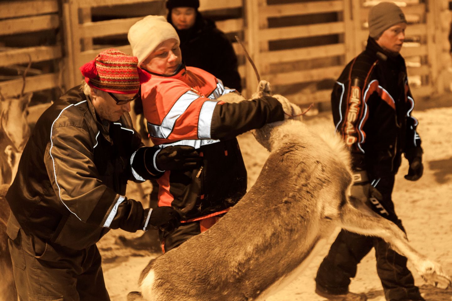
Reindeer separation by Sámi herders in Inari, Lapland, Finland. Credit: Alamy / Jorge Duarte Estevao. If this trend accelerates, the Sámi are in danger of becoming a linguistic minority. Opportunities to maintain the Sámi culture in urban areas are limited. It means adaptation, cultural change, loss, threats and problems – both physical and mental. In the worst case scenario, it will contribute to accelerating the integration of the Sámi into the mainstream culture. Researchers have reported that the changed circumstances have brought the Sámi stress and concern about the future of their own culture and way of life.
The most concrete health impact of climate change is the increase in accidents. My informants have reported a number of near-miss situations that have been caused by the fact that the ice did not withstand movement, as temperature fluctuations and large amounts of snow had weakened its carrying capacity, and the conditions were no longer what the reindeer were accustomed to. The survival strategy is to work and travel in groups, because it is difficult to get help quickly and a large part of the area is outside the mobile network.
There have been changes in species. Some alien species have come to Sámi under the influence of human activity – for example, raccoon dogs have been found in Kautokeino and roe deer are also found in Enontekiö. The reason is partly climate change, but above all human feeding. Our most important game species, the snow grouse, has suffered from a warming climate and is disappearing from its current territories in the central parts of the Arctic countries. Forestry and foxes are also contributing to its disappearance. Perhaps the most decisive thing to do is to consider how the reindeer can survive climate change itself. The reindeer are going hungry, and the warming conditions can be fatal for the Arctic animal.
By the end of the century, the climate in the Sámi region will be similar to the climate in southern Finland. Seasons have changed, but the warming climate brings new challenges – infrastructure, mining and industrial projects, as well as the environmental risks of the emerging Arctic sea route. In Finland, for example, there are ongoing discussions about the possibilities and boundary conditions for the implementation of the Arctic railway. It would not even be possible to talk about the Arctic railway plans without climate change.
We know less about the future effects of climate change than we should. There are a lot of causal relationships and things we don’t yet understand. Our region is so networked with global processes that our own actions have limited potential. It is generally said that what happens in the Arctic and with the climate does not stay in the Arctic. It could also be said that what happens in industrialized countries does not stay there, but comes directly or indirectly to the Sámi land – although then in the form of fine particles.
Climate change affects everyone and everything, from our brains all the way to micro-organisms. In human life, however, the changes are progressing quite slowly and one can adapt to them, but the question is how to maintain a culturally significant life and cultural richness also in the changing climate. Climate change is happening now and will be passed on to future generations. From the point of view of Sámi culture, the effects of climate change are intergenerational – the solutions and adaptations by this generation will be passed on to future generations as an inheritance, through changed business models, know-how, language and values and ideals.
-
By Karolina Sobczak-Szelc
Algeria, Morocco and Tunisia have a long history of migration to Europe. The destinations have changed over time: while France, Belgium and the Netherlands were major targets at first, later North Mediterranean countries such as Spain, Italy or Greece have been favoured, and now, though still very low in numbers, more and more migrants choose Central and Eastern European countries as their destination, including Poland.
Though these migratory movements used to be explained in largely economic or social terms, driven by labour force needs in destination countries, family reunification, or the inequalities between the developed North and still developing South, there is growing recognition that other factors may also be involved. Indeed, although economic forces continue to be the most important driver of movement between North Africa and Europe, many studies suggest that environmental factors may also be playing a role in the decision of some to migrate.
This is illustrated by the situation of inhabitants of the villages in the High Atlas Mountains, whose fields, contained by steep valley slopes, are inundated and covered with sand and stones by ash floods every year. In a very different context, oasis communities on the edge of the Sahara also struggle with environmental pressures as crops are dependent on erratic rainfall, limited groundwater supplies or water delivered from a reservoir hundreds of kilometres away. In many cases, climate change impacts may exacerbate existing social or economic issues. In desert areas of Tunisia, for example, where local agriculture relies on underground water reserves, access to them is limited by insufficient investments in infrastructure and further jeopardized by degradation of these precious water supplies. Other man-made changes, such as river diversion, dam construction and uncontrolled drilling, are also factors contributing to environmental scarcity and stress, but are again exacerbated by an increasingly extreme and unpredictable climate.
These are some of the challenges of everyday life in the arid and semi- arid regions of North Africa, and they may push some inhabitants to look for alternative sources of income to traditional agriculture. In these cases, migration may be the only feasible option. Mohamed,* an inhabitant of Mhamid in southern Morocco, where lack of water, degradation of vegetation and the spread of dunes have made traditional livelihoods increasingly difficult, has two sons who have both left the region to look for work elsewhere.
As he explains: ‘‘You can’t work any more in agriculture due to climate change. One year is good and then you have five or ten years of drought. That’s why my sons won’t stay here. They decided that they won’t stay here because, if it is good here for two years, it is good, but then there is drought and you have no work.’
Although the decision to migrate is complex and is often closely tied to social, economic and cultural considerations, such as the search for employment and networks with migrant communities elsewhere, research points to the significant role that environmental factors can play. It should be noted that within the Maghreb region, much of this migration takes place within countries, as members of rural communities relocate to larger cities to work in tourism, construction or other sectors. Given the restrictive policies in place across Europe and the significant costs associated with travel to Europe, whether through official channels or by other means, for most North Africans the possibility of reaching Europe remains remote.
Nevertheless, despite the increasing hostility of many European states to immigration, there is a long history of migration between certain countries, such as Tunisia and France, and migration continues to provide some North African nationals with the opportunity to alleviate shortfalls in agriculture and other sectors in their home countries by looking for work in Europe. Those who manage to reach Europe have a chance to earn enough money to support their relatives back home – thus providing not only the migrant but also his or her extended family with a coping strategy. In the current context, however, most are forced to attempt the journey to Europe through clandestine means, and only a minority of those who try succeed in doing so. And for those family members left behind, often struggling with economic and environmental challenges, the situation can be just as desperate.
Nationals of Maghreb countries make up a large proportion of both documented and undocumented migrants in the European Union (EU). According to EUROSTAT data, for example, in 2017 the largest group of new citizens in the EU member states were citizens of Morocco – 67,900, corresponding to 8.2 per cent of all citizenships granted. Meanwhile, in terms of irregular border crossings into the EU, FRONTEX figures show that Morocco, Algeria and Tunisia are among the top 10 sending countries. And although, in comparison to Western Europe, the number of migrants from Maghreb countries in Poland is still very low, there has nevertheless been a substantial rise in the number of citizens of those countries, whether arriving through official channels with a residence permit or trying to enter Poland clandestinely.
This is despite evidence of increasing hostility towards Muslims, migrants and refugees in Polish society, encouraged by divisive and in ammatory rhetoric in some mainstream media. But while migration itself has become an increasingly politicized issue – in particular, populist parties have managed to exploit xenophobic sentiments to boost their electoral share – there is still relatively little discussion of the different factors, including climate change and environmental stress, that may be driving this movement. With better information and more open discussion, it is possible that some of the stigma and misunderstandings faced by migrant communities in Europe might be reduced.
Ali, an Amazigh (or Berber) migrant from the Upper Dades Valley in Morocco, now living in Poland, emphasizes the dilemmas that many younger Moroccans feel when they decide to migrate. ‘It’s not that they don’t want to stay,’ Ali says. ‘They need to earn. They need to earn to survive. That’s why, if they stay there, they cannot make it.’ He is quick to identify environmental instability as a major factor in this.
‘You are at risk. Why? It is a mountainous area, each year the river swells over. More or less, the area is flooded. And the commodities get spoiled, wasted. So always they are at risk. Because these people, they rely on natural resources.’
The situation in the Dades Valley has deteriorated in large part due to the degradation of the local environment, as reduced vegetation cover has reduced water retention capacity in the area and so made it more vulnerable to flooding.
Today, people from those areas within the Maghreb that are most dependent on agriculture, and where young people have few or no prospects, face most pressure to migrate. The desperation of some is sufficiently strong that they are willing, despite Europe’s increasingly restrictive migration policy, to attempt the dangerous crossing of the Mediterranean in makeshift boats – a journey that frequently proves deadly, as was the case in November 2018 when a small boat full of migrants travelling towards the Canary Islands capsized near the coast of Tiznit province in Morocco. Only three people, all with Moroccan nationality, managed to reach the shore and alert the authorities. The other 22 migrants went missing in the waters off Morocco’s Atlantic coast. The links between climate change, environmental stress and migration to Europe in the Maghreb remain uncertain, and the variety of social and economic forces pushing thousands of Moroccans to leave their country are sufficiently complex that it is difficult to attribute the decision to migrate to climate change alone. Nevertheless, as understanding of this difficult issue improves, it may be the case that migration to Europe is framed not only as a coping strategy for unemployment and lack of opportunities, but also as an adaptive response to a changing climate.
Photo: 16-year old Zahra Ennaji carries a jug of water across the sand towards her family’s nomadic compound in the Sahara Desert near the southern village of Mhamid, Morocco. Credit: Panos / Giacomo Pirozzi.
-
By Charlotte Graham
Nenets are an indigenous Siberian people, whose traditional economy has long been rooted in nomadic reindeer-herding, fishing and hunting. The majority inhabit the Yamal Peninsula – meaning ‘edge of the world’ in the Nenets language. Though the Nenets live on the fringes of industrialized society, they are among the first populations to face the consequences of a changing climate.
Nenets came under Russian influence from the sixteenth century onwards. Under Soviet rule they were forcibly collectivized and their shamanist religion was attacked. A number of Nenets rebellions took place from the 1930s, but the community was largely sedentarized in the 1950s, and the region later saw a large influx of Slavic settlers employed in industry.
In 1990s the Russian energy company Gazprom initiated preparations for one of its biggest oil projects, the Yamal Megaproject, aimed at exploiting the peninsula’s gas reserves. This process soon led to large-scale destruction of plant cover and vegetation in the Yamal Peninsula, beginning a long period of environmental deterioration. In 2012, the first gas supplies were produced from the vast Bovanenkovo reserve, and billions of cubic metres of gas are now piped to Western Europe. As a result of this exploitation, many indigenous inhabitants have had to leave the Yamal Peninsula for fear of being forced to live in permanent settlements.
Today, the main problems confronting the Nenets are ecological damage deriving from exploitation of the Yamal region’s natural gas deposits, unemployment and alcoholism. Their nomadic lifestyle is now threatened as their migration routes have been disrupted by mining infrastructure, pollution and the effects of climate change. As a result, many young Nenets are forced to migrate to cities, where they frequently struggle to integrate and face a range of social problems.
As with other indigenous communities in the Russian Federation that depend on reindeer-herding for their cultures and livelihoods, a further key threat to the Nenets’ future is climate change. Warmer summers bring higher and denser shrub growth across the tundra, making it more difficult to gather and move reindeer herds. Rapid shifts in temperature can cause freezing rain, which, in turn, causes the lichen that reindeer depend on to be covered by a thick and often impenetrable layer of ice, with many dying as a result.
And the untimely melting of lake and river ice can make it difficult for Nenets to follow their reindeer’s traditional migration patterns. Indeed, certain parts of the permafrost that Nenets and their reindeer need to cross have ceased to exist in some places, and are only accessible in colder months elsewhere. Though Nenets also rely on hunting and fishing, reindeer herds are the sole livelihood of many, so a negative impact on this one species can be destructive for the entire community. Moreover, reindeer-herding is central to Nenets’ culture and traditions. Changing migration paths and scarcer pastures also mean that families have less access to medical services as they are forced to camp further from towns. Nenets can adapt by continuing to roam widely in search of pastures: the issue is whether mining and natural gas extraction will hamper their access to the necessary range of habitats. Ever-expanding gas and oil industries encroach on reindeer pasture territory, and so regions on the Yamal Peninsula (where the nomadic Nenets live and move around) are overgrazed. In addition, the new pipelines and other industrial infrastructure are creating further obstacles to traditional migration routes.
Empty oil barrels discarded on Nenets traditional land in the Western Siberian Yamal Peninsula, Russia. Credit: Alamy / Steve Morgan. Sadly, these impacts look likely to intensify in the coming years as the region continues to be targeted for development and fossil fuel extraction. The Yamal Peninsula holds more than one-fifth of Russia’s natural gas reserves, roughly as much as the entire reserves of the United States. These natural gas fields are situated along major herding routes, and there is currently a proposed pipeline to connect hubs at Bovanenkovo (already the largest gas eld in Yamal, which herds must cross to reach summer pastures) and Payuta with oil and gas terminals. Proposed railways also cut straight through traditional Nenets routes. A new gas eld called Kruzenshternskoye is to be constructed in the next few years on the Kara Sea coast, which will destroy prime areas of pasture, meaning even less grazing access for already weakened reindeer.
Many prominent activists from the Nenets community, specifically the Forest Nenets, have spoken publicly about the environmental challenges facing their community. Yuri Vella, for example, a prominent poet, environmentalist and social activist, was a former reindeer herder in the tundra of the Agan River who later organized protests on behalf of the Nenets people in Yamal, Varagansk, to raise awareness on the encroachment of gas and oil industries on their traditional territories. Vella also wrote in the Forest Nenets language, a significant move in an era in which most Nenets were encouraged to adopt Russian and discard their native language.
In the face of these changes, the Nenets people continue to be flexible and adaptive: they regularly cross pipelines and railroads and other Russian operations to follow their traditional migration routes, but climate change and the deteriorating local environment nevertheless pose an existential threat to every aspect of their lives. With the depletion of the natural resources on which they depend, an entire way of life goes too. Some Nenets have already responded to these changes by leaving their nomadic communities and assimilating in urban communities, though many reportedly struggle with high levels of alcoholism, unemployment and mental health issues as a result.
This profile is an edited version of the community profile featured in the Russian Federation country entry of MRG’s World Directory of Minorities and Indigenous Peoples.
Top photo: A Nenets woman herding reindeers in the Western Siberian Yamal Peninsula, Russia. Credit: Alamy / Steve Morgan.
Middle East and North Africa
- 01
Iraq: ‘Women are the backbone of the Marsh Arab community – as the effects of climate change are becoming more visible, it is becoming clearer that women are the first to suffer’
By Ali Khadr The Marsh Arabs, sometimes referred to as Ma’dan (‘the dweller in the plains’), are inhabitants of the Tigris and Euphrates marshlands in the south and east of Iraq. Comprising different tribes, the Marsh Arabs have developed…
0 min read
- 02
Morocco: Rising tensions between nomadic pastoralists and sedentary communities over land and water
By Nourredine Bessadi Although the overall number of remaining nomads has decreased significantly, with official estimates suggesting a decline from around 68,500 in 2004 to 25,300 in 2014, at the same time more and more nomads have been moving…
0 min read
- 03
Palestine: ‘Climate change is not just a natural phenomenon but a political one.’
By Muna Dajani Abeer Butmeh is an environmental activist from Palestine and coordinator of the Palestinian Environmental NGO Network (PENGON). She talks to Muna Dajani about her work with PENGON and how she sees climate justice as…
0 min read
- 04
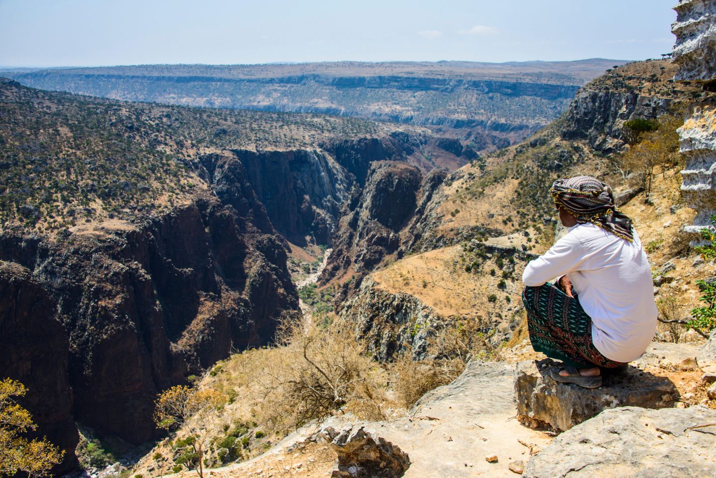
Yemen: As the civil war rages on, the island of Socotra battles with climate change
Socotra is an archipelago consisting of the islands of Socotra (also referred to as Soqotra), Abd al-Kuri, Samha, Darsa and the islets of Kal Farun and Sabuniya. Part of the Hadramawt governorate, it is situated in the Indian Ocean, south of…
0 min read
-
By Ali Khadr
The Marsh Arabs, sometimes referred to as Ma’dan (‘the dweller in the plains’), are inhabitants of the Tigris and Euphrates marshlands in the south and east of Iraq. Comprising different tribes, the Marsh Arabs have developed a unique culture that is firmly rooted in the aquatic environment of the marshes, a way of life that has been cultivated for thousands of years.
The Marsh Arabs of Iraq have long suffered from state marginalization, discrimination and violence, but they now face a new adversary – climate change. While water scarcity as a result of climate change is projected to be an acute challenge across the Middle East in the years to come, Iraq is especially vulnerable within the region. The southern marshlands of Iraq have already suffered significantly from shifting weather patterns and prolonged droughts, as well as man-made environmental changes. Soon, the numerous benefits that the marshes provide to their inhabitants may be lost – and with them, much of the distinctive Marsh Arab culture.
A female Marsh Arab collecting reeds in the historic Marshes of southern Iraq, January 2018. Credit: Ali Khadr. A history of environmental impact
The marshes of Iraq were once the largest wetlands in the Middle East and western Eurasia. In the 1970s, the marshes covered between 15,000 and 20,000 square kilometres of water surface and vegetation, comprising 17 per cent of the country’s surface area. During the 1980s and 1990s, however, Saddam Hussain subjected the marshes and their inhabitants to large-scale targeted destruction. The Marsh Arabs were accused of treachery against the regime, and as punishment much of the marshes were drained. A dam was built along the Euphrates River, south of Nasiriya, and Earth barriers were used to block the tributaries of the Tigris River that fed the marshes. Simultaneously, the waters were poisoned, and economic blockades were placed upon a population already suffering from the consequences of American sanctions.
As a result, in the space of just a few years, an ancient culture was on the verge of annihilation: in one month alone, between December 1991 and January 1992, more than 70 villages were destroyed and over 50,000 inhabitants uprooted from their homes. Those who stayed faced starvation and killings. A once thriving community of almost half a million in the 1950s dwindled to as little as 20,000 by the end of Hussein’s rule. While some of the Marsh Arabs sought refuge in neighbouring towns and cities, many of them were forced to flee to refugee camps in Iran.
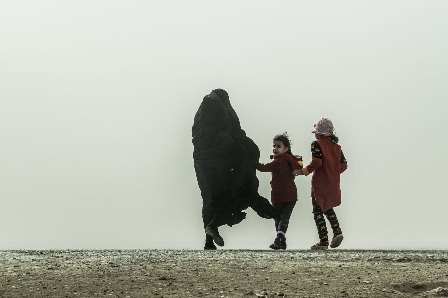
Mother and children rushing to seek shelter from the storm, Chibayish Marshes, Iraq, January 2018. Credit: Ali Khadr. Many of the Marsh Arab communities that fled during the Saddam regime returned to their homeland in 2003. This was a remarkable period of restoration as the marshes were brought back to life, with large swathes of the drained areas inundated once again. Yet increasing water scarcity is now threatening to undo much of this progress. This challenge was brought into sharp relief in the summer of 2018, when Iraq suffered its worst water shortage crisis in 80 years. This is in part due to dam construction projects in neighbouring countries, such as Turkey’s Southeastern Anatolian Project, Syria’s Tabqa dam and Iran’s Karkheh River dam, that have greatly reduced the country’s water supply. Mismanagement of water resources within Iraq itself, as well as other governance challenges, have also played a major part in the scarcity now afflicting the marshes.
Nevertheless, intersecting with these issues are the effects of climate change, with a recent report by the Expert Working Group on Climate- related Security Risks highlighting ‘prolonged heatwaves, erratic precipitation, higher than average temperatures and increased disaster intensity’ as some of the most pressing impacts now being felt in Iraq. Hotter spells and extended periods of drought have also led to a drop in water levels while at the same time salinity has risen to unhealthy levels. With temperatures currently reaching more than 40°C during the summer and predicted to rise by an average of 2°C by 2050, these effects are likely only to intensify in future.
Living with climate change in the marshlands
Combined with the added environmental stresses of poor water management and dam construction, climate change will affect the lives of Iraq’s Marsh Arabs in myriad ways. This is illustrated, to some extent, by the water crisis of 2018 and its impact on local agriculture, with livestock devastated in some areas of southern Iraq and hundreds of farming families reportedly forced to leave their homes in search of better irrigated land elsewhere. As many communities are largely dependent on agriculture for their livelihood, rising temperatures, drought and more frequent sand storms could increase the risk of displacement and migration. According to the Director of Antiquities and Heritage in Basra, Qahtan Al Abeed, the extent of the damage caused by fluctuating water levels in the marshes has driven many Marsh Arabs to leave their villages and head to the inner cities to make a living, returning only seasonally, depending on water levels.
Health is another area where climate change is projected to take a heavy toll. As reed production declines, and with it an important natural buffer for the hot winds that blow through the marshes, hotter temperatures and dust clouds from the desiccated marsh beds will have serious impacts on the Marsh Arab population. These include respiratory sicknesses, cancer and higher levels of infant mortality.
And, as elsewhere, women are likely to be particularly affected by these changes in the environment. Within the Marsh Arab community, women once played a very active role: while the men went out to sh, the women would gather reeds, herd water buffalo and other livestock, produce milk, cheese and yoghurt, make handicrafts such as rugs, scarfs and hand fans, look after the home and, at the end of the day, sell the fruits of their labour at the local market. ‘Women,’ says Al Abeed, ‘are the backbone of the Marsh Arab community. As the effects of climate change are becoming more visible, it is becoming clearer that the women within the marshlands are the first to suffer.’ The disappearance of fresh water, reeds and other natural resources has severely constrained the role of women in their society and reports suggest that, as a result, they are no longer passing traditional knowledge to the younger generations.
Looking ahead
Iraq’s ability to alleviate the impacts of climate change by modernizing water infrastructure and the agricultural sector have been debilitated by poor governance, corruption, war and the legacy of Saddam Hussein’s decades-long rule. If left neglected, the combination of climate change impacts, decreased water ow from Iraq’s neighbouring countries and poor infrastructure will create a catastrophe for the livelihoods and water security of hundreds of thousands of Iraqis, particularly the Marsh Arabs. According to Al Abeed, unexpected heavy rainfall over the wet season in 2019 resulted in the highest water levels the marshes have witnessed since 1975, indicating the drastic changes in weather patterns producing both droughts and floods.
With this in mind, the government has set up a working committee, headed by the Ministry of Water and joined by the Ministries of Culture, Environment, Oil, Agriculture and Education, tasked with ensuring the sustainable management of the marshes and the promotion of tourism in Iraq’s marshlands to inject much needed cash ow into the local economy. The preservation of Marsh Arab livelihoods, culture and heritage is now heavily dependent on the success of the committee’s initiatives. While the future remains uncertain, what is clear is that any lasting solution must be firmly rooted in a rights-based strategy to tackle climate change, addressing not only the changes in the local ecosystem but also their specific impacts on the Marsh Arab community themselves.
-
By Nourredine Bessadi
Although the overall number of remaining nomads has decreased significantly, with official estimates suggesting a decline from around 68,500 in 2004 to 25,300 in 2014, at the same time more and more nomads have been moving north, particularly to the Souss region, in search of land. These groups now stay longer, sometimes settling on the agricultural land of the predominantly Amazigh communities there – a situation that has led to at times deadly confrontations, especially as some groups of nomads are reportedly armed. With Amazigh struggling to protect their ancestral lands from encroachment on the one hand, and an impoverished nomadic population with little support from the Moroccan government to handle water shortages or lack of access to grazing on the other, there are challenges for both settled populations and pastoralists alike.
For Abdesslam, a Soussi based in Casablanca, ‘what has led to the recent violent clashes in the Souss region is the strong presence of nomads attracted by the fertile land to graze their animals, but also to sell certain agricultural products they would steal.’ The inhabitants of Souss call this ‘wild pastoralism’. He adds that ‘the Drâa River, the main source of water in the region, has suffered since the war [with Polisario Front] in the Sahara. The rain became more sporadic and temperatures got hotter.’
These pressures have already contributed to the erosion of traditional nomadic communities, with many families forced to relocate to urban areas as a means of survival. At the same time, for those who remain, relations with sedentary communities have become increasingly strained.While for decades nomadic groups would settle in the Souss region, this was generally at well-de ned periods in the seasonal migration cycle and largely con ned to specific grazing areas. As water and pastures have become more scarce, however, access to land has become a source of confrontation between sedentary and nomadic populations.
With rising temperatures, reduced rainfall and longer spells of drought predicted as a result of climate change, these con icts could intensify in future. With this in mind, in April 2018 a draft decree on the creation, development and management of pastoral areas was approved by the Government Council in Morocco. This project is part of the implementation of the provisions of law 113.13, relating to transhumance and the governance of pastoral areas. Officially, this project aims to create a framework for the management and development of pastoral areas to ensure their security and sustainability.
However, some residents of Souss consider this law to be a simple extension of discriminatory laws that date back to the colonial era and an inadequate response to the urgent need to manage the conflict between local residents and nomadic groups. This is sharpened by the sense that Moroccan authorities are themselves seen as violating the indigenous land rights of Amazigh in the region through overgrazing, mine development and the spread of wild boar for foreign game hunts, without meaningful consultation with the communities in question.
Indeed, in the eyes of many Amazigh, in the decades since independence Morocco has continued the environmental despoliation carried out under French colonial rule, when laws were passed to ‘legalize’ the dispossession of tribal territory and resources by the state. All this has accentuated their feelings of marginalization and stoked widespread protests throughout the latter part of 2018 against the Moroccan government. In response, the Akal Coordination Group, an alliance of local NGOs focusing on land rights, has called for the abolition of ‘dahirs, laws and colonial decrees expropriating the indigenous peoples from their lands’, as well as a more participatory approach to decision-making in this area.
As environmental pressures become more pressing and competition for resources raises the risk of intercommunal violence, it will be more important than ever that a clear framework for collaboration and conflict mitigation is in place. This is not only a question of sound land and water management, but also the protection of indigenous peoples’ rights over their territory and the possibility for nomadic populations to continue to have access to land in order to graze their animals and preserve their way of life.
* All the names of the interviewees have been changed. This case study is based on research funded by the National Science Centre, Poland as part of the project no 2014/13/D/HS4/03644 entitled ‘Environmental determinants of migration from countries of North Africa’.
-
By Muna Dajani
Abeer Butmeh is an environmental activist from Palestine and coordinator of the Palestinian Environmental NGO Network (PENGON). She talks to Muna Dajani about her work with PENGON and how she sees climate justice as central to the situation in the Occupied Palestinian Territories (OPT).
Working on environmental issues in the Occupied Palestinian Territories (OPT), and on climate change campaigns in particular, might not seem like a priority, especially in the context of the Israeli occupation. However, it is relevant as it pertains to the everyday access to natural resources, and their use and control. After decades of precarious conditions related to military and resource exploitation, working on combating climate change and its impacts cannot be separated from politics. Climate change is therefore not just a natural phenomenon but a political one, exacerbating pre-existing injustice and inequality. The Israeli occupation exacerbates the climate risks facing Palestinians by denying them the right to manage their land and resources, making them more vulnerable to climate-related events.
In the OPT, climate change advocacy and activism take place on two fronts: the global and the local. We, as civil society organizations and individuals, participate in the United Nations Framework Convention on Climate Change (UNFCCC)’s Conference of the Parties (COP), as we see these as a useful platform to highlight the effects of climate change and raise awareness of the impact of the Israeli occupation. While the Palestinian Authority (PA)’s role and ability to implement adaptation policies remain restricted, it is important to be represented at such conferences as they provide a platform for awareness-raising and advocacy on how to tackle climate change under conditions of military occupation and resource exploitation. The PA’s role in designing and implementing effective adaptation strategies is limited under such conditions – hence the need to work locally.
This is why we work on the Climate Justice campaign, which is an initiative to mainstream renewable energy through advocacy and lobbying. We believe energy transformation is critical for tackling climate change. Palestinians in the OPT are forced to depend on the infrastructure of the Israeli occupation for most of their electricity supply. Therefore, any climate justice advocacy must consider energy independence and sovereignty as its objective. At PENGON we are working on many issues that target women in the field of renewable energy. Climate change work in the OPT has largely disregarded the role of women. Our work at PENGON has focused on revising the PA’s energy strategy and relevant legislation to ensure gender is taken into account.
Our work also includes devising campaigns to confront controversial projects in which European countries are involved with Israel, with total disregard for the Israeli occupation and its practices, allowing for its normalization. One such campaign is against the underwater power cable known as the EuroAsia Interconnector, a project between Israel, Cyprus and Greece aimed at connecting the national grids of these countries. We participate in lobby tours in Europe to highlight how such endeavours are not only are detrimental for the environment, but also make European governments complicit in Israeli human rights violations and Israel’s occupation of Palestinian land and resources. Locally, we work on lobbying and advocacy in order to mainstream climate change in the PA’s national strategy. Also, many initiatives such as Earth Hour, Fridays for Future and others are also organized locally by Palestinian youth and civil society.
The agricultural communities are the most vocal about the impacts of climate change, as their livelihoods have been transformed by a combination of Israeli occupation practices and climatic shifts. Farmers have had to devise adaptive measures to overcome these factors, such as crop variation, water-saving irrigation methods and the adoption of traditional approaches to agriculture. However, farmers realize the complexity of adopting such strategies and implementing them on the ground. The Israeli occupation has now designated more than half of the agricultural land in the Jordan Valley as closed military zones. Consequently, Bedouin communities who depend heavily on pasture land and livestock have had to adapt to limited access to ever-shrinking areas and natural resources. Relying on rainwater for their agriculture and animal husbandry means that they are highly vulnerable and at risk because of fluctuating rainfall and temperature change. The injustice is exposed when comparing their situation to that of Israeli settlers, who enjoy a reliable water supply and support of their agricultural production.
Such protracted injustice regarding the conditions of resource distribution, combined with the imminent threat of climate change impacts on Palestinian communities, means that climate change is framed as a justice issue in Palestine and not merely an issue of state-led legislation. This is why the role of women is at the heart of the Climate Justice campaign. Some areas in the West Bank, such as the Jordan Valley, are prime examples of the unjust and unequal impacts of climate change on the same geographical areas. While Palestinian farmers in villages such as Al Auja suffer from drought and water scarcity, the illegal Israeli settlements nearby enjoy access to water for their irrigated lands.
We highlighted such unequal realities in ‘From Another Side’, an exhibition highlighting Israeli human rights violations in relation to the Palestinian environment. Using photos taken from the same location, one shot shows the reality of life in the Palestinian community, while the other shows the Israeli side in order to expose discrimination and injustice in resource distribution and access. We also focus on publishing reports and studies to highlight such realities and even lobby for accountability for such actions in UN institutions and the European Commission. We are lobbying against the Europe–Israel gas pipeline. We also worked on the Stop Mekorot campaign (Mekorot is the Israeli water company), raising awareness about how this company is implementing water injustice by controlling Palestinian access and rights to use their water sources, and denying Palestinians access. These campaigns are connecting the local with the global and creating linkages beyond borders to expose how injustice can be resisted and transformed. The struggle over climate injustice is therefore a collective struggle that we as Palestinians need to fight collectively with our allies and counterparts all over the world.
Recognizing the intergenerational aspect of climate change also pushes us, as environmental institutions and practitioners, to consider the role of youth in addressing this climate crisis and transforming it into an opportunity for positive change. We run initiatives, such as the sustainable schools project, that aim to enhance the skills of young environmental activists and highlight their potential in mainstreaming and tackling climate change issues. The active involvement of youth in global events such as Earth Hour is also indicative of how climate change is a global concern that requires local action.
Photo: A portrait of Abeer Butmeh, an environmental activist from Palestine. Romel De Vera.
-
Socotra is an archipelago consisting of the islands of Socotra (also referred to as Soqotra), Abd al-Kuri, Samha, Darsa and the islets of Kal Farun and Sabuniya. Part of the Hadramawt governorate, it is situated in the Indian Ocean, south of the Gulf of Aden, around 250 kilometres off the tip of the Horn of Africa. Its unique biodiversity, including its famous dragon’s blood tree, is due in part to its physical isolation: until relatively recently, Socotra was largely unreachable from Yemen during the entire monsoon season. It also hosts a wide variety of ora, fauna, reptiles, birds and other forms of wildlife that are endemic to the area.
Socotra’s population is as unique as the archipelago’s biosphere, and Socotris comprise a distinct ethnic group. Studies of Socotra’s population point again towards its isolation from the rest of the Arabian Peninsula. According to the 2004 Census, Socotra’s population totalled 42,842 inhabitants, although various sources cite around 60,000 at present. Socotris have their own language, an archaic yet living Afro- Asiatic and South Arabian language known as Socotri, that is only spoken on the archipelago and that includes a number of dialects. Though for centuries the inhabitants were Nestorian Christians, following the arrival of the Mehra sultanate on the island the inhabitants steadily Islamicized and today Socotris are almost entirely Muslim, split between Zaidis (an offshoot of Shi’a Islam), Sunni Sha ’is and smaller numbers of Ismailis on the archipelago. Socotra itself has remained largely undeveloped and acquired its first proper road only a few years ago.
Socotra has long been somewhat removed from developments on the Yemeni mainland. Following the takeover of Sana’a in 2014 by the Houthis, an armed group originating from Saada in the North, a coalition of Arab states led by Saudi Arabia launched a military campaign on Yemen in 2015, with the declared aim of restoring the internationally recognized government of President Abd-Rabbur Mansur Hadi. While the whole of Yemen has been ravaged by war since, Socotra, due to its natural isolation, was initially sheltered from it. However, later that year the islands were hit by two successive cyclones just a week apart – an unprecedented development that uprooted as much as a third of the island’s population and devastated the local environment. These highly unusual events were blamed by researchers on a combination of environmental pressures, including – besides the effects of El Niño – climate change and air pollution. Fears that Socotra could find itself exposed to further extreme weather in future were sadly confirmed in 2018 when another cyclone hit, further devastating the island’s limited infrastructure and leaving at least 19 people dead.
Mirroring these developments, the political situation for Socotra has also become more troubled as the United Arab Emirates has steadily established a presence on the island. While initially welcomed in 2015 when, in the midst of the destruction left by the cyclones, the country provided considerable humanitarian assistance to the population, since then its involvement has become more controversial. As one of the main actors in the Saudi-led coalition fighting in Yemen, the United Arab Emirates supports the local apparatus loyal to the Southern Transitional Council, a group that has frequently engaged in fighting with the Islah party, despite its ties to President Hadi. Tensions between the two have resulted in numerous clashes and the government of President Hadi, having previously supported the UAE’s move into Socotra, has since accused it of effectively staging an occupation. As a result, Socotra, until then largely sheltered from the conflict raging on the mainland, has seen some of the dynamics of the con ict spreading to its shores. Local resentment of UAE and its increasing military footprint, as well as its apparent annexation of the island as a base, have resulted in protests on the streets. New factions have been formed, with some demonstrating in support of Yemen while others carry UAE flags.
In this context, Socotra’s population must now recover from the trauma of its recent natural disasters, while political divisions on the island continue to increase. Just as they have played no part in the development of conflict on the mainland, so too the Socotri community has contributed little to climate change – and yet, like other communities on the frontline of global warming, they are now faced with its worst effects. With swathes of its wildlife devastated by the cyclones, development and climate change could further undermine Socotra’s fragile ecosystem – a situation that has prompted the International Union for Conservation of Nature (IUCN) to recommend the island to be listed on the UN Educational, Scientific and Cultural Organization (UNESCO)’s List of World Heritage in Danger.
This is an edited version of the community entry in the profile of Yemen in MRG’s online World Directory of Minorities and Indigenous Peoples.